

Schnebly Hill Trail No. 158
Starting from the Huckaby/Munds Wagon trailheads at the bottom of Schnebly Hill, Schnebly Hill Trail climbs moderately and steadily up the west face of Schnebly Hill following the original alignment of Schnebly Hill Road (Forest Road 153) for 4.3 miles till it reaches a small dirt turnout where the trail breaks off Schnebly Hill Road and follows its own trail back toward the south. From there, it climbs moderately in shade for nearly 0.75 mile, passing through 2 cattle gates, and emerging on a large, open expanse near Committee Tank.
There are several overlooks offering great views of Munds Mountain, Bear Wallow Canyon and the red rock formations beyond. The trail is level for the next quarter mile and then descends to a saddle separating Schnebly Hill and Munds Mountain at the head of Jacks Canyon. More nice views. Just before reaching the saddle, there is a signed trailhead on the left for Hot Loop. Continue down another 150 yards where there are two more signed trailheads. The Jacks Canyon Trail leads down to the left.
Photo Gallery


Specific Trail Information
Trail Number
Trail Type
General Information
- Difficulty: Strenuous.
- Trailhead Elevation: 4,460 ft. (at Huckaby/Munds Wagon trailhead).
- Elevation Gain: 1,970 ft. (near Committee Tank).
- Length: 6.3 miles one-way.
- Time: 4 hours roundtrip.
Red Rock Pass or America the Beautiful Pass required to park at the Huckaby trailhead.
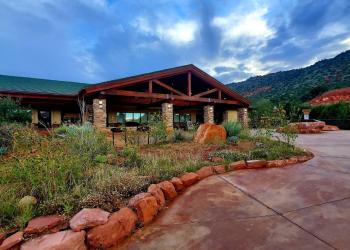
Address: 8375 State Route 179, Sedona, AZ 86351
Phone: 928-203-2900
Hours: Wednesday 12 p.m.-4:30 p.m. All other days, open 9 a.m.-4:30 p.m. Closed Thanksgiving, Christmas and New Year's Day.
Office Email: SM.FS.Cof_Webmail@usda.gov
Getting There
Directions
Location: 31 miles south of Flagstaff in scenic Red Rock Country.
Access: From the junction of Routes 89A and 179, take 179 south 0.3 miles. Turn left on Schnebly Hill Road just past the Oak Creek Bridge and go 5 miles (0.6 miles beyond the winter closure gate) to a turnout on the left. Park here and walk 100 yards down the road to the signed trailhead for Schnebly Hill Trail on the east side. Schnebly Hill Rd. is a very rough and rutted road. High clearance and four-wheel drive vehicles are necessary.
GPS (Map): 34°51'57.5"N 111°44'55.1"W