
Official websites use .gov
A .gov
website belongs to an official government organization in the
United States.
Secure .gov websites use HTTPS
A lock
(
) or https:// means you've safely
connected to the .gov website. Share sensitive information only
on official, secure websites.


Twining Campground
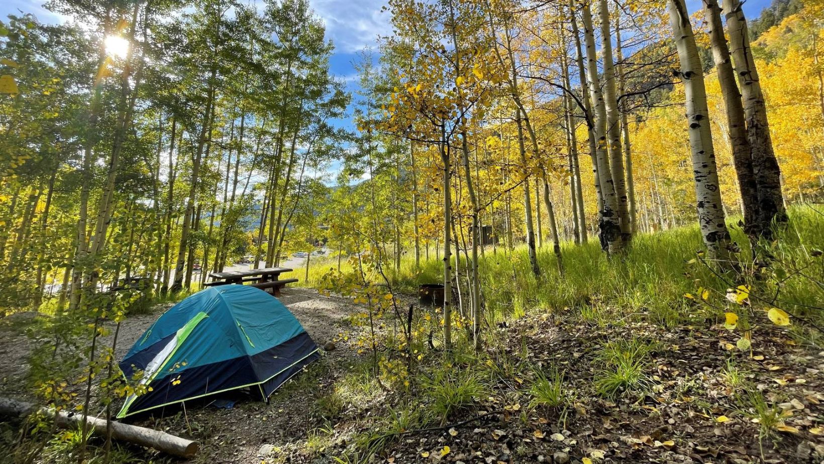
Tucked in an aspen grove just aside Taos Ski Valley’s lower parking lot, this four-site campground for tents makes for quick access to the Bull of the Woods Trailhead right across Twining Road. The campground is unique for its location: You trade solitude for walkable access to the resort village. Nonetheless, many find the spot just perfect for their needs, whether it’s acclimating at 9,500 feet or enjoying the best of a ski village while camping under the stars.
Nearby Recreation
- Trails: The Wheeler Peak Trail starts at the Bull of the Woods Trailhead, just a couple hundred feet away. The trail leads to the eponymous peak, first connecting to the Long Canyon and Gold Hill trails in the Columbine-Hondo Wilderness in its first few miles. Closer to the peak, it connects to Lost Lake Trail, providing access to the other side of the ridge. Other nearby trails include the Williams Lake Trail, its trailhead about two road miles through the community of Taos Ski Valley, and the four popular canyon trails back down the mountain along Highway 150: Gavilan, Italianos, Manzanita Canyon and Yerba Canyon.
- Fishing: The campground is located along the Rio Hondo, a popular river for fishing. Stream access is available upstream along the Wheeler Peak Trail or downstream along Highway 150 (please be cognizant of private property in some areas).
- Fall Color: Taos Ski Valley is an excellent leaf peeping area due to numerous aspen groves found throughout the valley, on trails and along the Rio Hondo. Peak color usually to occurs in late September and early October.
At a Glance
| Current Conditions: | No water. Remove all trash, including human waste. Parking may be difficult due to proximity to ski area. Accessibility to campground is weather dependent. |
|---|---|
| Reservations: | First come, first served |
| Area Amenities: | Tent camping, Picnic tables, Toilets, Parking |
| Usage: | Light |
| Closest Towns: | Taos Ski Valley, Arroyo Seco, Taos |
| Water: | No |
| Restroom: | No |
| Operated By: | Forest Service |
| Information Center: | For more information contact: Questa Ranger District |
Activities
Campground Camping
Open May through September. 4 campsites at elevation 7,300.
| No. of Sites | 4 single site(s) |
| Reservation Info | Not reservable |
| No. of Accessible sites | None |
River and Stream Fishing
Day Hiking
Picnicking
Open from May through September.Amenities
| Picnic tables: | |
|---|---|
| Tent camping: | |
| Parking: | Use parking spots in lot |
| Toilets: | Use Bull of the Woods Trailhead bathroom |