
Official websites use .gov
A .gov
website belongs to an official government organization in the
United States.
Secure .gov websites use HTTPS
A lock
(
) or https:// means you've safely
connected to the .gov website. Share sensitive information only
on official, secure websites.


Fred Haught Trail No. 141
 PARTIAL CLOSURE FROM PINCHOT CABIN AND BEAR CANYON FOR WASHOUT: This historic trail is part of the Cabin Loop Trail System. It was named after a rancher who once used it to move cattle and supplies from ridge to ridge and valley to valley in the roadless wilderness above the Mogollon Rim. Today it provides hikers and horsebackers access to this scenic area of shallow canyons and forested ridges.
The Fred Haught trail was almost lost to neglect after a system of ridge top roads replaced it as the main route for commerce and travel in the 1950's. However, a renewed interest in the area by recreationists and history buffs inspired its recent reopening.
You'll find a hike along this trail leisurely and scenic, with a good chance to see wildlife and ample opportunity to imagine what it must have been like when horses and trails were the only way of traversing this picturesque countryside.

The monument of the Battle of Big Dry Wash shown here is just off of FR 300 at the beginning of the Fred Haught Trail.
Arizona Trail Passage 28 (Blue Ridge) uses the first three miles of Fred Haught Trail, from General Springs Cabin to just before the confluence of General Springs and Fred Haught Canyons, where the AZT-28 splits off to the west to head up to C.C. Cragin Reservoir.
Hover mouse cursor over photo to display slideshow controls.
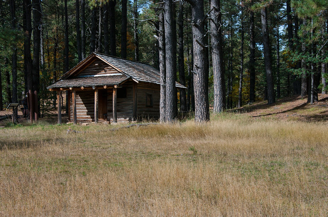
Photo (above): General Springs Cabin, located near the Fred Haught Trailhead just off the General Crook Trail, aka Rim Road (FR 300). Photo by Deborah Lee Soltesz/USFS (2015).
At a Glance
| Usage: | Medium |
|---|---|
| Closest Towns: | Happy Jack, AZ |
| Operated By: | Mogollon Rim District - 928-477-2255 |
General Information
Directions:Location: 65 miles (about 2 hours) south of Flagstaff in the cool pines of Mogollon Rim country.
GPS:
Access: Drive about 55 Miles south of Flagstaff on Forest Highway 3. Drive north 9 miles on AZ 87 to FR 95. Turn south (right) about 8 miles to FR 139A. Turn left on 139A to the trailhead. FH 3 and AZ 87 are paved. FR 95 is graveled and suitable for passenger vehicles except during winter when it is closed.
Maps
- The Digital Travel Map Whether you're driving, hiking, riding, or exploring, you will find this full-color, GPS-enabled map a handy reference to have on your mobile device. The map show trails, recreation sites, major landmarks, and forest roads.
- Forest Service Topo Map (FSTopo Geo-enable PDF)
- More Maps:
- Arizona Trail Passages: Maps and Descriptions. This trail is part of the Arizona Trail Passage 28 (AZT-28).
- USDA FSGeodata Clearinghouse: Arizona FSTopo Maps available for download in Geo-enabled PDF and GeoTIFF formats. Note: USGS 7.5 Minute (1:24K) Topo Maps and FSTopo Maps use the same title.
- USFS Store: Map Locator & Downloader purchase or download USGS topographic maps. Note: USGS 7.5 Minute (1:24K) Topo Maps and 1:24K FSTopo Maps use the same title.
Click map image for printable view.


General Notes:
Rating: Moderate
Hiking time: 3 hours
Notes:
- No motor vehicles.
- Be prepared to follow blazes, the path is faint and hard to see.
- The first half of this trail is the same as the Arizona Trail Blue Ridge Segment (AZT-28) and is maintained.
- The last half of the Fred Haught is not maintained.
- There is water on this trail.