
Official websites use .gov
A .gov
website belongs to an official government organization in the
United States.
Secure .gov websites use HTTPS
A lock
(
) or https:// means you've safely
connected to the .gov website. Share sensitive information only
on official, secure websites.


Hoist Lake Area
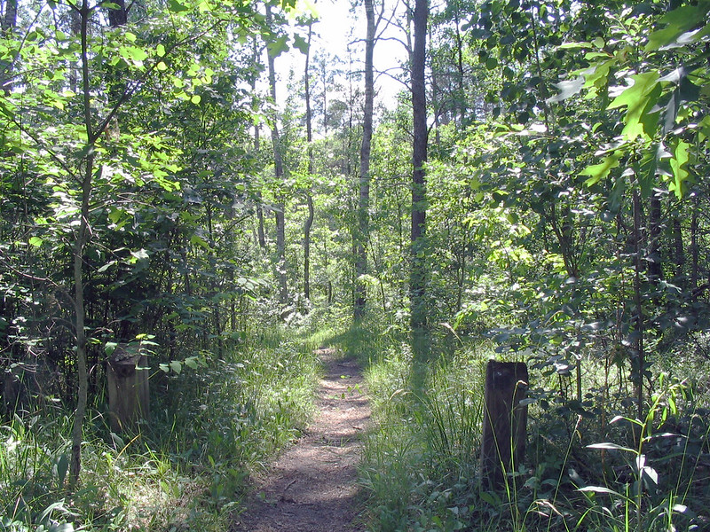
Hoist Lake foot travel area encompasses almost 10,000 acres of pine, aspen and hardwood forest. There are 19 miles of looped trail. Hiking trails and back-country skiing are permitted; however, there are no groomed trails. Cross country skiing ranges from moderate to more difficult/most difficult due to length of trails. Hiking ranges from moderate to more difficult/most difficult. Hunting and fishing are permitted in season.
At a Glance
| Operational Hours: | Open 24 hours a day, 7 days a week unless otherwise posted. |
|---|---|
| Area Amenities: | Parking |
| Fees: | Recreation Day Use Fee
|
| Permit Info: | Special Use Permit -
|
| Usage: | Light |
| Best Season: | January 1 to December 31 |
| Restrictions: | Allowed -
|
| Closest Towns: | Curran |
| Water: | Vault |
| Restroom: | None |
| Operated By: | Huron Shores Ranger Station - (989) 739-0728 |
| Information Center: |
|
General Information
Directions:Hoist Lake East Trailhead and Parking Lot
From Grayling -
- Travel east on M-72 for 22 miles.
- Turn left and travel north on M-72/M-33 for 5 miles.
- Turn right and travel east on M-72 for 15.9 miles.
- Turn right and travel south on M-65/M-72 for 6.5 miles.
- Turn right and travel west on FR 4182 for <.5 miles.
- The site is located on the right.
From Harrisville -
- Travel west on M-72 for 22 miles.
- Turn left and travel south on M-65 for .5 miles.
- Turn right and travel west on FR 4182 for <.5 miles.
- The site is located on the right.
Hoist Lake West Trailhead and Parking Lot
From Grayling -
- Travel east on M-72 for 22 miles.
- Turn left and travel north on M-72/M-33 for 5 miles.
- Turn right and travel east on M-72 for 15.9 miles.
- Turn right and travel south on M-65/M-72 for .75 miles.
- Turn right and travel west on F-32/Aspen Alley Rd. for 5 miles.
- Turn left and travel south on FR 3977 for <.5 miles.
- The site is located on the right.
General Notes:
Location - Hoist/Reid Lake Areas
Nearby Recreation Areas -
- Reid Lake Area
- Horseshoe Lake Campground
- Horseshoe Lake Boat Launch
- O'Brien Lake
Acreage - 9,700
County - Alcona
Seasonal and Other Information -
- This site is not gated during the off season
-
This site is not maintained in winter:
- Access road and/or parking lot are not plowed.
- No water and/or toilet facilties are available.
Activities
Lake and Pond Fishing
| Fishing Mode | Boat, Shore, Wade |
| Fish Species |
North Hoist Lake: Sunfish
South Hoist Lake: Trout |
| Fishing Platform | No |
| Cleaning Station | No |
| Water Temperature | Cold |
| Accessible Platform | No |
| Fishing Method | Fly, Pole |
| Water/Flow Level |
Maximum depth:
North Hoist Lake: 10 feet South Hoist Lake: 24 feet |
Ice Fishing
Day Hiking
Backpacking
Picnicking
| No. of Sites |
|
| Reservation Info | No reservation needed. All sites are first come, first served. |
Boating - Non-Motorized
There are several small lakes within the area. Boating is carry-in only.
XC Skiing/Snowshoeing
Amenities
| Parking: | Trailheads - 17 vehicle capacity |
|---|