


Williams Creek Trail
Another challenging hike in the Weminuche Wilderness, Williams Creek Trail (587) ascends 3,400 feet to the Continental Divide Trail (813). The trail crosses a couple of streams, which may be difficult during high water, and climbs three fairly steep sections are along the way.
The first few miles of the trail have previously been described with the Spanish name Huerto: garden-like. At approximately mile 2.4, the trail reaches the junction with Indian Creek Trail (588) which travels east along Indian Creek to Palisade Meadows and the Continental Divide. Continue to a crossing of Williams Creek and begin ascending more assertively in a walled canyon that bends and turns.
At mile 7.4, there is a turn off on your right to the Williams Fork Lake Trail (664) which climbs to Williams Lake and the Continental Divide. Stay west at this junction, soon climbing multiple switchbacks, passing a small lake on the east and joining the Continental Divide Trail No. 813.
- Distance (one-way): 9.6 miles
- Minimum / starting elevation: 8,370 feet
- Maximum / ending elevation: 11,920 feet


Specific Trail Information
Trail Number
General Information
This trail is located in the Weminuche Wilderness. Please review the Wilderness Regulations for full list of regulations and restrictions. Regulations include:
- Possession of motorized equipment or motorized means of transport are not permitted.
- Mechanized means of transport are not permitted (mountain bikes).
- Flying drones is not permitted over congressionally designated wilderness areas or primitive areas as many people seek these places for the opportunities for solitude and quiet that they provide.
- Group size is limited to 15 people.
- Combination of people and stock = 25.
- Dogs under control.
- No unattended campfires.
- Camping is not allowed within 100 feet of any water source.
- Outfitter-guides who receive any form of compensation must obtain a special-use permit to operate on public land.
- Check trailhead signs or Forest Service Offices for site-specific camping, campfire, and livestock regulations.
- Practice leave no trace ethics.
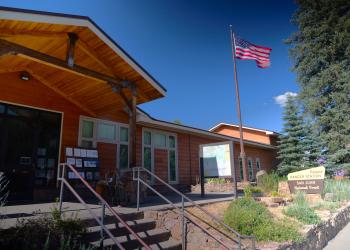
Address: 180 Pagosa Street Pagosa Springs, CO 81147
Phone: (719) 851-7377
Hours: Monday - Friday: 8am - 12pm; 1pm - 4:30pm (Closed on federal holidays)
Office Email: SM.FS.PagosaRD@usda.gov
Getting There
Trailhead/Starting Points
Williams Creek Trailhead - restrooms available.
Directions
From downtown Pagosa Springs, head west on US-160. Turn right/north onto Piedra Road (CR 600/FS 631) and travel for 22-miles to the intersection with the FS 640 (Williams Creek Road). Turn north and drive an additional 4.9-miles to the trailhead located at the end of the road and next to the Palisades Horse Campground.


