
Research Paper RMRS-RP-9
Fire Behavior Associated with the 1994 South Canyon Fire on Storm
King Mountain, Colorado
Research Paper RMRS-RP-9
Fire Behavior Associated with the 1994 South Canyon Fire on Storm King Mountain, Colorado
Fire Chronology
Figure 18 -- Topographical map showing locations important to narrative. Map is oriented south to north for use with figure 17. Dashed lines indicate firelines along West Flank and Main Ridge.
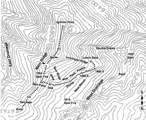
Title: Fire Chronology: Figure 18: RMRS-RP-9
- Fire Behavior Associated with the 1994 South Canyon Fire on
Storm King Mountain, Colorado
Publish Date: February 5, 1999
Last Update: December
22, 2005