Back | Next | Home
Missoula Technology &
Development Center
| Table
of Contents Back | Next | Home |
Missoula Technology & Development Center |
Treatment of Petroleum-Contaminated Soils
Because of the topography of the Tongass and Chugach National Forests, the climate can change drastically in a short distance. Unfortunately, weather station data is only available for a few locations in the areas of the national forests. The available data are provided as a reference for possible conditions that could be encountered in the national forests. Table 7 shows the location for each data set and the corresponding national forest closest to the weather station. Figures 6 to 8 show the monthly maximum, average, and minimum temperatures. Figures 9 to 11 provide the monthly average total precipitation for representative sites in each national forest.
| Chugach National Forest |
|---|
| Valdez, Whittier, Seward |
| Tongass National Forest |
| Ketchikan, Wrangell, Petersburg, Sitka, Juneau |
These data show minimum monthly average temperatures ranging from about –2 °C (Sitka) to –12 °C (Valdez). In the colder regions, average low temperatures that fall below 0 °C are sustained for 6 to 7 months (Valdez and Seward). While these low temperatures are not extreme lows, as would be seen in interior and Arctic regions of Alaska, they will influence the operation of some treatment systems, such as landfarming. These weather stations are at low elevations where temperatures would be warmer than at higher elevations. Figures 9 to 11 show that the maximum monthly rainfall ranges from 20 to 60 centimeters.
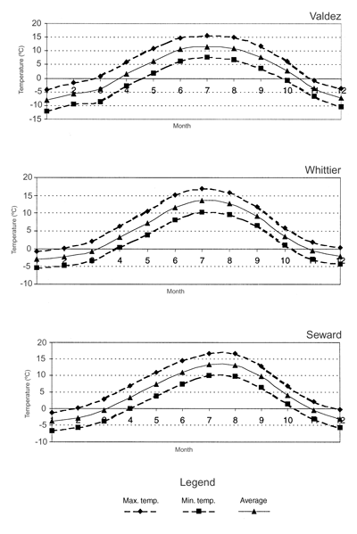
Figure 6—Representative monthly temperature data for the
Chugach National Forest.—Alaska Climate Research Center,
University of Alaska Fairbanks.

Figure 7—Representative monthly temperature data for the
Tongass National Forest.—Alaska Climate Research Center,
University of Alaska Fairbanks.
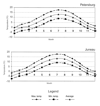
Figure 8—Representative monthly temperature data for the
Tongass National Forest.—Alaska Climate Research Center,
University of Alaska Fairbanks.

Figure 9—Representative monthly precipitation data for the
Chugach National Forest.—Alaska Climate Research Center,
University of Alaska Fairbanks.
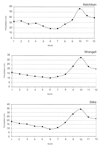
Figure 10—Representative monthly precipitation data for the
Tongass National Forest.—Alaska Climate Research Center,
University of Alaska Fairbanks.
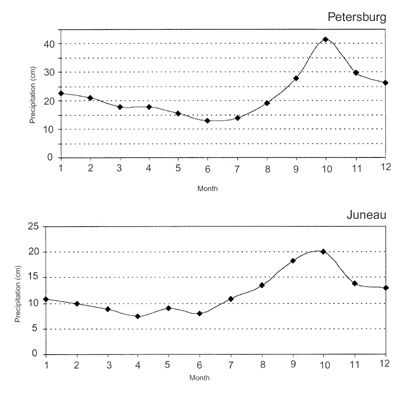
Figure 11—Representative monthly precipitation data for the
Tongass National Forest.—Alaska Climate Research Center,
University of Alaska Fairbanks.
|
|
Back | Next Table of Contents |
Missoula Technology & Development Center |
