

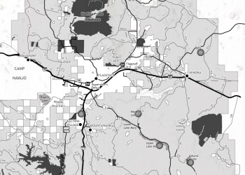
Visitor Maps and Guides
The Coconino National Forest has a variety of digital maps available to help you navigate your way around the forest.
Maps are available in two formats:
- Digital maps that can be downloaded as PDF files
- Avenza Maps, a third-party smartphone application. Avenza Maps is a free app that allows your device's built-in GPS to track your location on a pre-downloaded map.
You can use the links below to access maps for driving, recreating, hunting and more.
Motor Vehicle Use Maps
MVUMs contains essential information about road, trail and area designations for motorists. The free MVUM is the legal document-of-record that shows the roads, trails and areas designated as open to motorized vehicle use on Coconino National Forest.
Driving a motorized vehicle on roads, trails or areas not designated for motor vehicle use is prohibited.
Travel Map For Your Desktop

In addition to the MVUM map links on this page, you can also download the Travel Map, in color and with shaded relief. Download the map to your computer by clicking on the button below.
Travel Map For Your Phone

The Coconino National Forest Travel Map is also available through Avenza. This free map enables users to use their device's GPS location in real time.
Firewood Maps
The Coconino provides firewood for personal use both on a free-use permit and a paid permit basis.
Firewood Map
Visit our permits page for maps and other information.
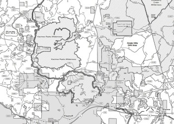
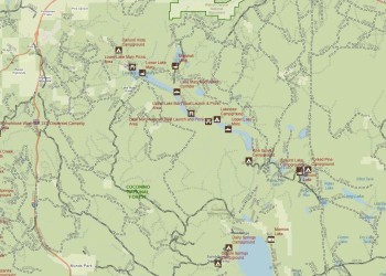
Recreation Maps
If you're looking to hike, camp, backpack, snowmobile or horseback ride, these are the maps for you.
Cinder Hills OHV Map
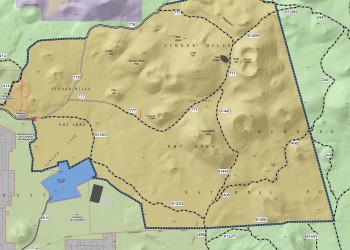
This map is georeferenced to work with your phone via the Avenza Maps app.
Snowmobile Map
Map of areas where over-snow motorized (aka: snowmobile) use is allowed.
Hard Copy Visitor Map

Plastic, weather-proof map shows most Forest Service system roads and trailheads, and are a 1/2" = 1 mile scale. They are planimetric and show some spot elevations.
Cost $14
National Forests Interactive Map
Featuring an interactive map of Forest Service roads, trails, recreation sites, wilderness areas, and wild & scenic rivers. Just click on the map to get more information about that favorite site you're heading to!
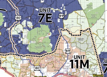
Hunting Maps
Maps to assist you in your hunting endeavors.
Coconino NF Elk Retrieval Map
Arizona Game & Fish Department Interactive Hunting Map

Quiet Areas
Three designated quiet areas provide unique recreational opportunities on the Coconino National Forest. A Forest Order established these quiet areas to allow hunters to practice traditional, non-motorized hunting techniques and give other recreationists places to enjoy a serene forest experience.
These areas are accessible by motorized vehicles during spring and summer months for fuelwood gathering, sightseeing, timber harvesting, and many other uses. However, during fall and winter months, motorized vehicle use is restricted to allow unique recreation opportunities and greater opportunities for hunting.
Pine Grove Quiet Area

Open to foot, horse and bicycle traffic only between August 15 and December 31.
Rattlesnake Quiet Area

Open to foot, horse and bicycle traffic only between August 15 and December 31.
Woods Canyon Big Game Winter Habitat Seasonal Closure Area
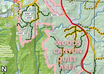
Open to vehicles: April 2 to December 15.
This area is closed to motor vehicles from December 15 to April 1 annually to minimize disturbance to big game winter habitats. Roads within the area are closed, but the road along the perimeter is open to motorized travel. Schnebly Hill Road (FR 153) is not affected by this closure. Hunting during season, hiking, horseback riding, and bicycling is allowed during this closure. Game retrieval using motorized vehicle is not permitted during the closure.