
Visitor Maps and Guides
Get ready for your visit by checking out our detailed maps, brochures, and information guides. Visitor maps and publications are available online.
Forest Overview Maps and Visitor Guides
Mobile Friendly Maps

Download available forest & grassland maps to your mobile device via the Avenza app. The Gifford Pinchot National Forest Motor Vehicle Use Map and Special Forest Products Map are both free on Avenza.
Printed Maps

Hard-copy Forest Visitor Maps are available at local vendors, Ranger District Offices and online through U.S. Geological Survey or DiscoverNW.org.
FSTopo

These free downloadable geo-enabled quadrangle maps are created by the U.S. Forest Service.
Motor Vehicle Use Map

The Motor Vehicle Use Map shows the roads, trails and areas where you can legally drive. These roads, trails and areas are designated by type of motor vehicle allowed and the allowable season of use.
Interactive Visitor Map
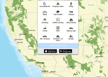
View the National Interactive Visitor Map to explore recreation sites on Forest Service lands across the country.
Geospatial Data
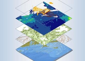
Digital data (GIS) is available at the USDA Forest Service Geodata Clearinghouse.
View a list of all Forest Service maps available at Avenza Map Store in Oregon & Washington by area.
Download a spreadsheet inventory of all available Forest Service Recreation, Ranger District, Wilderness, and Special Area maps for the Pacific Northwest Region.
Printable and digital state highway maps, links to traffic and bike maps, as well as live road conditions and camera at White Pass on US-12.Other Maps and Publications