
Visitor Maps and Guides
The US Forest Service provides several types of publications and maps to the public. The material is available in many forms: brochures, maps, Recreational Opportunity Guides (ROGs), on such subjects as recreation, sightseeing, wilderness, travel management, and vegetation.
Forest Maps
The Forest Service publishes a variety of map products to help you plan your next adventure or enjoy your next visit.
For example:
- You can purchase National Forest Visitor Maps and a variety of other maps through our partner organization, Sierra Forever.
- Several types of mobile compatible maps are available from Avenza Maps.
- US Geological Survey website offers USGS Topographic Maps and National Forest Visitor Maps for purchase on-line.
- California Trail Users Coalition (CTUC) OHV Trail Maps are for navigation. The maps can be downloaded on-line or requested by email.
In general, forest visitor and other kinds of maps may also be purchased at Inyo National Forest Visitor Centers.
Wilderness and Topographic Maps
- Wilderness Maps are topographic maps that show natural features such as mountains, valleys, plains, lakes, rivers, and vegetation using contour lines depicting elevation gain or loss. Each map covers all or part of one wilderness area and the scale is generally 1 inch per mile (1:63,360). Twenty-Eight wilderness maps are available for purchase through the U.S. Geological Survey Store.
- FSTopo is the Forest Service series of large scale topographic maps. FS Topo maps are 7.5 minute, 1:24,000-scale over the conterminous United States, and 15 minute X 20-22.5 minute, 1:63,360-scale over Alaska. These maps are available for download at Forest Service Topography Maps.
Motor Vehicle Use Maps (MVUM)
The Motor Vehicle Use Map depicts National Forest System routes (roads and trails) or areas designated open to motorized travel. The Motor Vehicle Use Map also displays uses allowed by vehicle class (highway-legal vehicles, vehicles less than 50 inches wide and motorcycles), and seasonal allowances.
Click here to find a Map - MVUMs
- MVUM - Bald Mountain
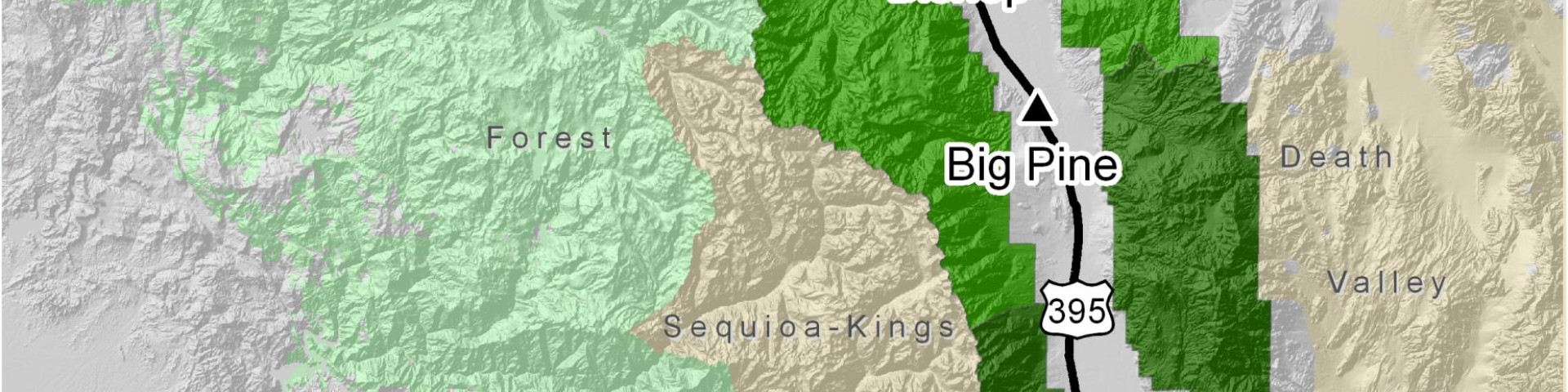
- MVUM - Big Pine
- MVUM - Bishop
- MVUM - Casa Diablo
- MVUM - Glass Mountain
- MVUM - Inyo Mountains
- MVUM - June Lake
- MVUM - Little Antelope Valley
- MVUM - Mammoth
- MVUM - Monache
- MVUM - Mono Lake
- MVUM - Pizona /Montgomery Peak
- MVUM - Southern Sierra
- MVUM - White Mountains
Forest Publications
Our publications fall into a few broad categories: administrative, general, recreation and research publications.
Recreation Opportunity Guides
These are just a sampling of the types of handouts that are free at your local forest office.
Mono Lake
Mammoth Ranger District
- Hiking Trail Mileage & Elevations
- Hiking Ansel Adams Wilderness
- Hiking John Muir Wilderness
- Hiking Mammoth Pass & Red Cones
- Hiking Convict Lake Area
- Hiking McGee Creek
- Hiking Rock Creek
- Hiking Mono Basin
- Hiking Saddlebag Lake
- Dispersed Camping
White Mountain Ranger District
- Camping at Rock Creek
- Camping at Bishop Creek
- Dispersed Camping
- Hiking Horton Lakes
- Hiking Bishop Creek North Fork
- Hiking Bishop Creek South Fork
- Hiking Big Pine Creek
- Birch Lake and Red Lake Trailheads
Mt. Whitney Ranger District
- Camping at Lone Pine & Independence
- Camping at Horseshoe Meadow
- Hiking Baxter Pass Trail
- Hiking Blackrock Trailhead
- Hiking Cottonwood Pass / Big Whitney Meadow
- Hiking Cottonwood Lakes / New Army Pass
- Hiking Kearsarge Pass
- Hiking Meysan Lakes
- Hiking Mt. Whitney Trail
- Hiking North Fork Lone Pine Creek
- Hiking Olancha & Haiwee Pass Trails
- Hiking Robinson Lake Trail
- Hiking Sawmill Pass
- Hiking Shepherd Pass
- Hiking Trail Pass
- Hiking Tuttle Creek
- Hiking Whitney Portal National Recreation Trail
Helpful Resources
Special Publications
Donations are appreciated for special publications
- "Backroad Tours in the Eastern Sierra: Inyo County" (pdf, 1.7mb) This guide is a cooperative project of the land management agencies and chambers of commerce. Our goal is to encourage you to spend time in the Eastern Sierra and Death Valley and enjoy and care for its irreplaceable wonders.
- "Wildflower Hot Spots of the Eastern Sierra" (pdf, 4.7mb) Twelve wildflower sites represent the diversity of environments that are found throughout the Eastern Sierra with directions, a map, GPS coordinates, a description of the natural history of the area, plant lists, and photos.