
Coyote Coulee Trailhead
This site provides parking for passenger vehicles and horse trailers, and a vault toilet. This trailhead provides access for the Coyote Coulee loop trail system (Trail #127). This trail system is popular for hiking, horseback and biking that will take you through forest, meadows, aspen, and creek crossings with an elevation gain and drop of 1500 feet. The Coyote Coulee loop trail system loops a figure eight for Hayes Creek and Brown Jug. The first loop is 4 miles and the second is 2.6 with a mile of trail connecting them making the total 8.9 miles.
General Information
Open year-round, snow dependent
24 hrs
Pack it in, Pack it out
No fees are required for this site
Contact Name: Darby-Sula Ranger District
Contact Phone: 406-821-3913
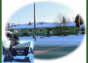
Address: 712 N. Main Darby, MT 59829
Phone: 406-821-3913
Hours: Monday-Friday, 8:00 a.m. - 4:30 p.m. (Closed on federal holidays)
Getting There
Latitude / Longitude
Latitude: 46.12194444
Longitude: -114.2288889
Directions
From Darby travel 7 miles north on Highway 93. Turn west (left) on Lost Horse Road/FS429 and travel 2.1 miles. Turn north (right) onto FS 496 and follow approximately 0.25 miles to the trailhead.
Facility and Amenity Information
Water
Potable water is not available at this site.
Horse/Pack Animal Information
Horse/Pack animals are allowed at this site.