
Shooting
Our Forests and Grassland offers dispersed shooting and shooting at developed ranges. Both options can accommodate training needs for shooters while adhering to federal rules and regulations, local restrictions, and standard firearm safety practices.
Sport Shooting Partners

The Arapaho and Roosevelt National Forests and Pawnee National Grassland is part of the Northern Front Range Sport Shooting Partnership, comprised of Boulder, Clear Creek, Gilpin and Larimer counties and Colorado Parks and Wildlife. This group helped the Forest with the Recreational Sport Shooting Decision, signed in 2019, that identified unsuitable areas for shooting in an effort to increase public safety. Closing these areas is contingent on public shooting ranges opening to provide opportunities for recreational shooters. The Devils Nose Target Range is opened August 13, 2025, and the Clear Creek Shooting Park is under construction with plans to open in spring of 2026.
Shooting Closures & the Dingell Act
The Arapaho and Roosevelt National Forests and Pawnee National Grassland is committed to working towards implementation of the 2019 Recreational Sport Shooting Management Decision and Forest Plan Amendment, identifying unsuitable areas for shooting on National Forest System lands. These closures are contingent on shooting ranges being constructed in certain geographic areas to provide for safe shooting opportunities where dispersed opportunities are limited. Implementation of closures is also contingent on compliance with public notice and comment procedures required by the John D. Dingell, Jr. Conservation, Management, and Recreation Act.
The Devils Nose Target Range on the Clear Creek Ranger District opened August 13, 2025. The Clear Creek Shooting Sports Park is under development with an expected opening in spring of 2026. As these ranges open, closures will begin in their associated geographic areas, as outlined in the 2019 Decision.
The intent of these closures is to protect public safety by improving management of recreational sport shooting. They are a result of more than a decade of a unique federal, state, and county partnership aimed to carefully consider and balance all Forest user needs and access, while also prioritizing public safety. When fully implemented, the 226,113 acres identified as unsuitable for shooting will be closed.
Please note that the Forest previously received and responded to comments about these shooting restrictions as part of the planning process for the Recreational Sport Shooting Management Project. All previously raised information and issues were analyzed in the project’s environmental analysis. Details of the project, including the analysis and final decision are available online.
- Dingell Act Justification Document
- Dingell Act Response to Comments
- Closure Order tied to Devils Nose Target Range opening
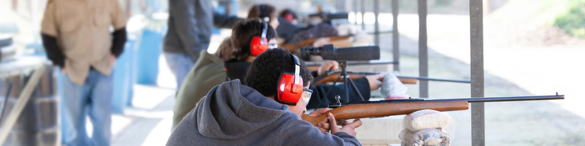
Shooting at Developed Ranges
Visit a local range and follow all safety regulations for that range. Baker Draw is open year-round on the Pawnee National Grassland and Devil's Nose is open seasonally on the Clear Creek Ranger District of the Arapaho National Forest. Colorado Parks & Wildlife also maintains a list of shooting ranges across the state for public use.
Dispersed Shooting & Restrictions
According to the Code of Federal Regulations (title 36), recreational shooting can take place on the National Forests and Grasslands under these conditions:
- You are at least 150 yards from a residence, building, campsite, developed recreation area or occupied area.
- You are not shooting across or on a National Forest System Road or an adjacent body of water.
- You are not shooting into or within a cave.
- You are not shooting in any manner or place where any person, property or resource is exposed to injury or damage as a result of such discharge.
- You are not firing any tracer bullet or incendiary ammunition.
For safety reasons some areas have been closed to discharging a firearm. These restrictions are in place in addition to the Code of Federal Regulations. These closures do not apply to legal hunting activities.
Boulder Ranger District (National Forest System lands near Boulder, Nederland & Allenspark)
See a consolidated map of shooting closures on the Boulder Ranger District.
- Brainard Lake Recreational Area
- Former Allenspark Dump
- South Nederland Closure
- Flood Related Shooting Closure - James Canyon, Lefthand Canyon, Mount Alto, and Sugarloaf Mountain
- Lefthand Slot Canyon Closure
- Lefthand Entrance Closure
Canyon Lakes Ranger District (National Forest System lands in Larimer County)
Clear Creek Ranger District (National Forest System lands near Idaho Springs & Georgetown)
Pawnee National Grassland (National Forest System lands in Weld County)
South of County Road 96 and West of County Road 63. The closure is located in Township 8 North, Range 63 West, Section 7.
Please note: Shooting is not allowed in the area along County Road 61 due to the lack of safe backstops.
Sulphur Ranger District (National Forest System Lands near Sulphur Springs)
Weapons Safety Rules
- Treat every weapon as if it were loaded.
- Never point a weapon at anything you do not intend to shoot.
- Keep your finger straight and off the trigger, until you are ready to fire.
- Keep the weapon on safe, until you intend to fire.
- Know your target and what lies beyond.
Local Target and Alcohol Regulations
- You may only shoot targets that are:
- cardboard,
- paper,
- self-healing,
- manufactured metallic (metal targets specifically designed for firearms),
- or manufactured thrown-type clay (clay pigeons)
- Wooden backing on targets is not allowed.
- You may not possess an open container of an alcoholic beverage while discharging a firearm. See shooting restrictions and area closures for details.
- You may not use an explosive, including exploding targets.
Know Before You Go
Check out this sport shooting safety video series. This video series was created to help new and experienced target shooters have a safe and successful experience on public lands.
Reporting Illegal Shooting
If you believe you have witnessed illegal shooting in a closed area, email details including date and location information. If an emergency, call 9-1-1.