
Devil's Head Lookout Tower
The Devil's Head Fire Lookout Tower is listed on the National Register of Historic Places. The base of the tower can be reached via the Devil's Head Trail (#611), a 1.4-mile long route with an elevation gain of 865 feet. The lookout is situated at 9,748 feet elevation.
The site is historically significant for its long association with conservation efforts of the U.S. Forest Service in Colorado. In 1907, the newly created Forest Service planned seven principal lookouts along the Front Range of the Rockies between New Mexico and Wyoming. Devil's Head was selected to be the location of one of these lookouts. It was one of only four lookouts that were eventually established: three in Colorado and one in Wyoming. In addition to Devil's Head, there were Twin Sisters, near Estes Park; Squaw Peak, near Mount Blue Sky and Medicine Bow Peak in Wyoming. The site has been in continuous use since 1912 and is the last full time lookout in Colorado.


Active Alerts
General Information
The lookout may be open to public visitation when staffed.
Mid-June to October
Winter closure information: Rampart Range Road (#300) is closed annually by December 1 and remains closed throughout the winter. The road reopens when conditions are favorable for summer recreation. A target date is April 1, but weather conditions may delay opening until late May.
The following restrictions apply to this campground:
- Hours for parking and trail use are limited to one hour before sunrise and one hour after sunset.
- No overnight camping and no campfires are allowed.
- Dogs must be leashed at all times and are not allowed on the tower stairs or inside the lookout.
- Follow the "pack it in/pack it out" principle.
- Practice Leave No Trace principles.
- Stay on the designated trail. Do not cut switchbacks.
Dogs must be leashed at all times and are not allowed on the tower stairs or inside the lookout.
Contact Phone: 303-275-5610
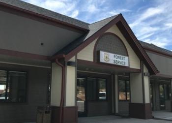
Address: 30403 Kings Valley Drive, Suite 2-115 Conifer, CO 80433
Phone: 303-275-5610
Hours: Monday-Friday, 8:00 a.m. – 4:30 p.m. (Closed on federal holidays)
Getting There
Elevation
9,748 feet
Directions
The Devil's Head Trailhead can be reached by traveling approximately 10 miles west of Sedalia on Highway 67 to the Rampart Range Road. Turn left (south) onto Rampart Range Road and drive about 8 1/2 miles to the trailhead.
Parking
Parking is available at the Devil's Head Trailhead or at the overflow area located at the junction of Forest Service Road 300.
Facility and Amenity Information
Restrooms
Restrooms are not available at this site.
Water
Potable water is not available at this site.