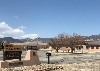
Saguache Ranger District

Address: 46525 State Highway 114 Saguache, CO 81149
Hours of Operation: Monday through Friday / 9:00 to 3:30 (Closed on federal holidays)
Office Phone: (719) 655-2547
Mailing Address: 46525 State Highway 114 Saguache, CO 81149
Additional Office Information
Often billed as being like “old Colorado,” the Saguache District is a pristine public land use area that is generally devoid of crowds and provides many recreational opportunities.
Saguache (pronounced Suh-watch) is a Ute Indian word that means, “water at the blue earth.” The Saguache District includes the northernmost headwaters of the Rio Grande on the eastern side of the Continental Divide. Snowmelt from the La Garita Mountains supplies water to not only the Rio Grande River Basin, but also replenishes the large aquifer located below the fertile farmlands of the San Luis Valley.
The Saguache Ranger District manages 515,750 acres of the Rio Grande National Forest stretching from the rugged Sangre de Cristo Mountains on the east to the San Juan Mountains and the Continental Divide on the west. The “lower” edges of the district start at about 8000 feet in elevation while the highest peaks in the Sangre de Cristo Wilderness scratch the clouds at over 14,000 feet.
From the High Peaks to the Valley Floor
The Sangre de Cristo Mountains form the San Luis Valley’s rugged eastern rim. This incredible landscape is protected in the Sangre de Cristo Wilderness Area. The section of the range that lies within the Saguache Ranger District includes many 13,000 and 14,000 foot peaks. There are many trails that provide access to this range.
Across the valley to the west, the San Juan Mountains rise gently from the valley floor. More than 50 miles of the Continental Divide forms the district’s western boundary. The Saguache District also manages a portion of the La Garita Wilderness, the least visited wilderness area in Colorado. The southern part of the district is a geologist's delight where you can see rocks formed by ash flows that were spewed out more than 28 million years ago by one of the largest known volcanic eruptions that created the La Garita Caldera.
The Saguache Ranger District Office no longer houses the BLM field office as it has moved to Monte Vista, Colorado. Basic information about BLM-managed lands on the valley floor and along the foothills within the district can still be obtained at the Saguache office. For more specific information about the BLM, please contact their main office in Monte Vista at 719-852-7074.
Often billed as being like “old Colorado,” the Saguache District is a pristine public land use area that is generally devoid of crowds and provides traditional activities of simple camping, fishing, hunting, and sleeping under the stars just like in the old days. If you want to get away from it all, the Saguache Ranger District is the place you need to be.


