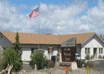
Mix Lake Campground
Located near Platoro Reservoir, the campground offers 22 sites with tables and fireplaces. There are 3 vault type toilets, trash receptacles, ample parking with convenient trailer spaces and drinking water. The campground sits at 10,000 feet above sea level and overlooks Mix Lake.
General Information
The campground has convenient access to the Conejos River, the San Juan Wilderness, Platoro Reservoir, and other nearby ponds, lakes & numerous trailheads in the area. Mix Lake Campground is one mile west of Platoro in the Conejos River drainage. This is a good access point for the South San Juan Wilderness. Mix Lake, Platoro Reservoir, Conejos River, Lily Pond and Kerr Lake can all be accessed for fishing. The Mix Lake Overlook is on-site, and campers can also visit the nearby historic town of Platoro.
Memorial Day to Labor Day
Quiet hours are from 10:00 pm to 6:00 am.
Interagency Senior/Access Recreation Passes provide a 50% discount to single campsites ONLY.
*The discount applies only to the fee for the campsite physically occupied by the pass holder, not to any additional fee or campsite(s) occupied by members of the pass holder's party.
Visit the USGS store for passes at https://store.usgs.gov/recreational-passes.
Interagency Recreation Passes are Honored for Day Use.
Fires must remain inside the metal fire ring. Make sure your fire is "Dead Out" and cold to the touch before leaving the site. Ensure doors on bear proof trash cans are secure and use proper food storage techniques in the campground. There is private land in the area. Be sure to obtain permission before entering these areas.
Day Use:
$12 per day
Overnight Use:
Single Site: $26 per night
Dogs must be on leash not longer than six feet in length.
The nearby resort community of Platoro also offers boat and canoe rentals, trail rides, and a store.
Contact Name: Conejos Peak Ranger District
Contact Phone: 719-274-8971
Address: 15571 County Road T5 La Jara, CO 81140
Phone: (719) 274-8971
Hours: Monday through Friday / 9:00 to 3:30 (Closed on federal holidays)
Getting There
Latitude / Longitude
Latitude: 37.35805491
Longitude: -106.5426804
Elevation
10,000
Directions
Directions from Monte Vista, Colorado: Take Colorado Highway 17 south 12.0 miles. Take the Twelve Mile Road 12.0 miles west to the forest boundary where it becomes the Alamosa-Conejos River Road #250. Follow #250 17.0 miles up the Alamosa River and over Stunner Pass to Mix Lake.
Directions from Antonito, Colorado: Take Colorado Highway 17 west 23.0 miles to the Alamosa-Conejos River Road #250 at Elk Creek. Follow #250 23 miles up the Conejos River to Mix Lake.
Travel Considerations
Motorized travel may be restricted by snow and annual seasonal road closures from March 15th to May 15th.
Parking
Maximum length RV is 40'.
Facility and Amenity Information
Restrooms
Restrooms are available at this site.
Water
Potable water is available at this site.
Water from streams and lakes should be purified before consumption.
Picnic Tables
Picnic tables are available at this site.
Horse/Pack Animal Information
Horse/Pack animals are not allowed at this site.


