

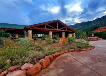
Honanki Heritage Site
Honanki and its sister site, Palatki, were the largest cliff dwellings of the Red Rock country between AD 1150 - 1350. The Sinagua, ancestors of the Hopi, lived here preparing meals, raising their families, and making tools from stone, leather, and wood. Nearby they hunted for deer and rabbit, tended various crops, and gathered edible wild plants. They were first described by Dr. Jesse Walter Fewkes, famous turn-of-the century archaeologist from the Smithsonian Institution, who gave them the Hopi names of Honanki (Badger House) and Palatki (Red House). The Hopi, however, have no specific names for these sites.


General Information
Open from 9:30 a.m. to 3 p.m. seven days a week. Closed Thanksgiving and Christmas.
A Red Rock Pass or an America the Beautiful Interagency Pass required on all vehicles parked at our cultural sites. Daily and Weekly Red Rock Passes can be purchased at this site from the self-serve vending machine.
Prior to visiting, please read visit the Safety and Outdoor Ethics page, which includes archaeological and heritage site etiquette guides.
Day Use:
$5 per vehicle per day
$15 per week
$20 per annual
Pets are not allowed beyond the parking lot.
Address: 8375 State Route 179, Sedona, AZ 86351
Phone: 928-203-2900
Hours: Wednesday 12 p.m.-4:30 p.m. All other days, open 9 a.m.-4:30 p.m. Closed Thanksgiving, Christmas and New Year's Day.
Office Email: SM.FS.Cof_Webmail@usda.gov
Getting There
Latitude / Longitude
Latitude: 34.93679
Longitude: -111.93448
Elevation
4725 ft.
Directions
Location: 17 miles northwest of Sedona, Arizona.
GPS (Map): 34°56'12.7"N 111°56'03.5"W
From Sedona: Take state Route 89A through West Sedona and continue past the last traffic light for five miles. Just past mile marker 365, turn right onto Forest Road 525. Follow FR 525 for 9.5 miles. Just past the cattleguard at Loy Canyon trailhead you will bear to the left to go around some private property.
Alternative Route from Sedona: From SR 89A, take Dry Creek Road and follow the signs for Enchantment Resort/Loy Butte. At the road to the Enchantment Resort, turn left onto Boynton Pass Road (FR 152C), and follow the signs for Loy Butte/Palatki (FR 525 to FR 795, pass FR 795 and continue up 525 2.5 miles to Honanki).
Travel Considerations
The road to this site is generally passable to passenger cars when dry, but it is not regularly maintained and has some rough and rocky stretches. High clearance vehicle recommended.
Facility and Amenity Information
Restrooms
Restrooms are available at this site.
Water
Potable water is not available at this site.