

Broken Arrow Trail No. 125
Broken Arrow Trail No. 125 is an easy and popular hike on a good trail with great red rock scenery. It's heavily used by mountain bikers, so be sure to keep an eye out for them. The trail is unshaded and can be hot in summer. Begin at the signed trailhead which will direct you across the jeep road to the trail. After 200 feet, the trail bears left (south) and soon crosses a ledge at the foot of Battlement Mesa.
Explore, then return to the trail and continue as it gradually climbs to some scenic red rock outcrops beside Twin Buttes on the right. Continue to the end of the trail at Chicken Point at 1½ miles for more great views. Return by the same route.
At 0.5 mile from Chicken Point, take the short side path to the right signed for Submarine Rock. Walk this interesting formation, and then return by the same path to the main trail. Continue north to complete the hike of about 3.5 miles (roundtrip including Submarine Rock). The adjacent roads are used by Jeep tours.
Specific Trail Information
Trail Number
Trail Type
General Information
- Difficulty: Moderately easy with spectacular views.
- Trailhead Elevation: 4,282 ft.
- Elevation Gain: 344 ft.
- Length: 1.5 miles.
- Time: 1 hour one way.
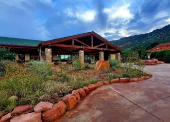
Address: 8375 State Route 179, Sedona, AZ 86351
Phone: 928-203-2900
Hours: Wednesday 12 p.m.-4:30 p.m. All other days, open 9 a.m.-4:30 p.m.
Office Email: SM.FS.Cof_Webmail@usda.gov
Getting There
Directions
Location: 30 miles south of Flagstaff in scenic Red Rock Country.
Access: From the junction of Routes 89A and 179 in Sedona, take 179 south 1.4 miles to Morgan Road on the left (east). Go .6 miles to the end of the pavement, cross the cattle guard and continue for another 80 yards to trailhead parking on the left.
GPS (Map): 34°50'44.0"N 111°45'24.7"W