Schultz Creek Trail No. 152
Schultz Creek Trail is part of the Mount Elden/ Dry Lake Hills Trail System (MEDL), Schultz Tank Trail System, and the Schultz Creek Loops Trail System.
The Schultz Creek area is the entry point to the MEDL trail system located to the north and west of Flagstaff. This area, located just outside Flagstaff city limits, is a highly desired location for runners, hikers, cyclists and horseback riders. The trails enable a variety of loop options by connecting trails in Dry Lake Hills with Schultz Creek and Rocky Ridge trails.
The Schultz Creek Loops includes 7.7 miles of new, natural surface singletrack trail: Big Bang highlights the unique and dramatic landscape of Dry Lake Hills; Space Walk is slightly less than a mile and circumnavigates the smaller hill locally known as 2nd bench providing several trail connections with massive views of both the San Francisco Peaks and Flagstaff; Dipper trail traverses the front side of the 2nd bench and is an enjoyable climb or descent; Pluto is a short connector between Space Walk and Dipper trails through a unique drainage that provides a different experience on several rock slabs; Apollo extends from Dipper to create a connection to Rocky Ridge trail and is an easily accessible trail from the popular Schultz Creek Trailhead.
If you hike this trail during a quiet time, Abert's squirrels and Steller's jays are animals you might see here. During late spring and early summer this is a good place to hear the musical trill of the Hermit thrush.
Specific Trail Information
Trail Number
Trail Type
General Information
- Difficulty: Moderate
- Trailhead Elevation: 7,201 ft.
- Elevation Change: 916 ft.
- Length: 4.5 miles one way
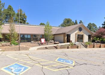
Address: 5075 N. Highway 89, Flagstaff, AZ 86001
Phone: 928-526-0866
Hours: Monday-Friday, 8 a.m. - 4 p.m. (Closed on federal holidays)
Office Email: SM.FS.Cof_Webmail@usda.gov
Getting There
Directions
Location: 3 miles north of Flagstaff.
Access: From Flagstaff: Drive northwest on Fort Valley Road (U.S. Route 180) for roughly 3 miles. Turn right to head east onto Schultz Pass Road. The trailhead is roughly half a mile further at the intersection of Schultz Pass Road and Elden Lookout Road, commonly referred to locally as "The Y."
GPS (Map): 35°14'23.3"N 111°39'38.7"W


