
Wilson Mountain Trail No. 10
This hike heads straight for some of the most panoramic views in the Oak Creek Canyon/Sedona area. Plan a full day for it and start early — the climb up Wilson Mountain is a strenuous one. The majority of the 2,300 foot climb is packed into the first mile or so of the hike. You'll have more reasons than just exertion to stop and take a breather along this route, however. The views start as soon as you leave the car and they just keep getting better.
There is shade along parts of this trail but enough of it is out in the open to make it hot work under a summer sun. An alternate, cooler route is provided by North Wilson Trail No. 123 which starts just north of Encinoso Picnic Area, 3 miles up canyon from Midgley Bridge. The two trails join at a point midway up the mountain.
At the top you'll be rewarded with views that stretch over hundreds of square miles of scenic canyon country and include Oak Creek Canyon, Sedona, Coffee Pot Rock, Capitol Butte, Sterling Canyon and the Verde Valley.
Specific Trail Information
Trail Number
Trail Type
General Information
- Difficulty: Strenuous and challenging with steep ascents.
- Trailhead Elevation: 4,550 ft.
- Elevation Gain: 2,400 ft.
- Length: 5.6 miles.
- Time: 2.5 hours one way.
Red Rock Pass or America the Beautiful Pass required to park at the trailhead.
- No motorized or mechanized vehicles permitted in the Wilderness, including mountain bikes.
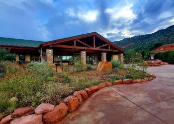
Address: 8375 State Route 179, Sedona, AZ 86351
Phone: 928-203-2900
Hours: Wednesday 12 p.m.-4:30 p.m. All other days, open 9 a.m.-4:30 p.m.
Office Email: SM.FS.Cof_Webmail@usda.gov
Getting There
Directions
Location: 22 miles south of Flagstaff (2 miles north of Sedona) on paved roads in scenic Oak Creek Canyon. Elevation ranges from 4,600 to 6,900 ft.
Access: Drive 22 miles south of Flagstaff or 2 miles north of Sedona on U. S. 89A. The trailhead is just north of Midgley Bridge where you'll find a small parking lot and a monument to Richard Wilson who was killed by a grizzly in this area in 1885.
GPS (Map): 34°53'11.9"N 111°44'31.0"W