

Pena Blanca Lake
This medium-sized lake fills nearly 50 acres of Peña Blanca Canyon in the foothills of the Atascosa and Pajarito Mountains. It is surrounded by grassy, oak-dotted hills, some of which are topped with bluffs of limestone.
Pena Blanca Lake is a popular recreation spot for visitors from neighboring Nogales, Arizona, and nearby communities in Mexico. On weekends and some weekdays, during the peak summer season, this area can be quite crowded. On holidays, especially Easter, it becomes extremely crowded.
Peña Blanca Lake is named for the white cliffs (peñas blancas) of volcanic tuff that jut out from the surrounding hillsides. The lake sits in the foothills of the Atascosa and Pajarito Mountains at the southern end of the Tumacacori Highlands, an area known for its fascinating geological formations and rich biological diversity. The Highlands are
comprised of three ranges: the Pajarito, Atascosa, and Tumacacori Mountains. Atascosa Peak, the tallest in the area at 6,422 feet, is visible from the lake. The peak and range are aptly named from the Spanish word atasco, meaning “obstruction,” referring to the steep ridges and bands of cliffs that define the area.
Intermittent streams cut canyons through these mountains and create habitat for a variety of wildlife, including javelina, white-tailed deer, black bear, coatimundi, and mountain lion. The area is known for harboring a great diversity of snakes, many of which are more common in tropical areas to the south. The lake and surrounding landscape are also a hotspot for birding. Numerous species of waterfowl winter at the lake, while migratory warblers, tanagers, orioles, flycatchers, and other songbirds visit the lake in spring and fall. Herons and egrets are common along the shore.
The Arizona Game and Fish Department built an earthen dam in 1957 to retain the north-flowing waters of Peña Blanca Wash and create this lake for recreational fishing. Today, the Department manages the lake for trophy largemouth bass and seasonal trout fishing.
The area offers a boat ramp, fishing piers, a lakeshore trail, and picnic areas.
Download the Peña Blanca Lake Visitor Guide in English.
Descarga la guía del visitante en español a Peña Blanca Lake.
Border crossing by undocumented immigrants and illegal entry of those smuggling contraband into the United States is common in this area. Be aware of your surroundings, stay on designated trails, and report any suspicious activity to the Border Patrol, 800 BE ALERT or (800) 232-5378.
Pena Blanca Lake Photo Gallery


General Information
Day use only
Proof of payment, or a valid Coronado National Forest Annual Pass or Interagency (America the Beautiful) Pass, including the Annual, Senior, Access, or Military Pass, must be displayed on the driver's side of the vehicle dashboard. Learn more about accepted passes.
Day Use:
$8 per vehicle per day
$10 per vehicle per week
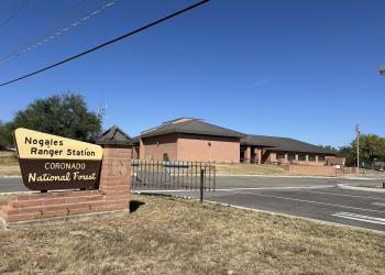
Address: 303 Old Tucson Rd. Nogales, AZ 85621
Phone: (520) 761-6000
Hours: 8:00 a.m. - 4:30 p.m. Monday-Friday (Closed on federal holidays)
Getting There
Latitude / Longitude
Latitude: 31.39638889
Longitude: -111.0852778
Directions
Turn west off Interstate 19 approximately 8 miles north of Nogales at the Peña Blanca–Ruby Road (AZ Hwy 289) exit. Follow this road about 9 miles to Peña Blanca Lake Recreation Area. Turn right (north) on the paved road that leads to the lake and the boat launching ramp.
Parking
Paved parking lot with pull-through trailer parking.
Facility and Amenity Information
Water
Potable water is not available at this site.
Picnic Tables
Picnic tables are available at this site.
Horse/Pack Animal Information
Horse/Pack animals are allowed at this site.
Recreation Opportunities
Day Hikes Info
The 1.5-mile (round trip) Children’s Forest Discovery Trail begins at the north end of the boat ramp and follows along the western shore of the lake to the dam. Enjoy the shade of oak trees and watching wildlife along the way.
Fishing - Lake & Pond Info
Quiet coves and shoreline vegetation provide habitat for a variety of fish, including catfish, bass, and sunfish. Rainbow trout are stocked during the cooler months. Three fishing piers are available near the boat ramp. All anglers 10 years and older need a valid fishing license. Bag limits and fish consumption advisories are posted on site.
Boating - Non-Motorized Info
A paved boat ramp and nearly 50 acres of lake to explore make this a perfect destination for a day on the water. All boats with motors are limited to one 10 horsepower motor or less. Great for canoes, kayaks, and paddle boards. Bring your own watercraft; no rentals available.
Swimming Info
Swim at your own risk. Levels of contaminants, including mercury, might be present in the lake and are not routinely monitored. There is no designated swimming area and no lifeguard on duty. Swimming is prohibited near the boat ramp.
Boating - Motorized Info
A paved boat ramp and nearly 50 acres of lake to explore make this a perfect destination for a day on the water. All boats with motors are limited to one 10 horsepower motor or less. Great for canoes, kayaks, and paddle boards. Bring your own watercraft; no rentals available.
Picnicking - Groups Info
Four developed picnic areas offer scenic views, along with shaded tables, charcoal grills, vault toilets, and bear-safe trash receptacles. Upper Thumb Rock Picnic Area has a horseshoe pit and piñata pole.
Picnicking - Single Info
Four developed picnic areas offer scenic views, along with shaded tables, charcoal grills, vault toilets, and bear-safe trash receptacles. Upper Thumb Rock Picnic Area has a horseshoe pit and piñata pole.
Scenic Driving Info
If you have a high-clearance vehicle, Ruby Road turns to dirt just west of the lake and continues for 25 miles through the Atascosa Mountains. Take in the stunning scenery and see historic mining and ranching sites along the drive. Return the way you came, or continue to Arivaca and take the paved route back to I-19. Allow 2–3 hours for the 55-mile loop. Drive with caution; watch for open-range cattle.
Viewing Wildlife Info
Numerous species of waterfowl winter at the lake, while migratory warblers, tanagers, orioles, flycatchers, and other songbirds visit the lake in spring and fall. Herons and egrets are common along the shore.