
Sycamore Rim Trail #45
The Sycamore Rim Trail was first proposed in 1975. Born of the idea that this environment of ponds, streams, cliffs and deep canyons was unique, and worthy of preservation in as nearly an undisturbed condition as possible, the trail was built to provide access to the area so people could enjoy it without impacting its scenic values. Its route was originally cleared and marked in 1979, when the trail was first opened for general use. Since then, this loop has been improved with work over the entire length of the trail. The Sycamore Falls Trailhead was added during the summer of 1988 to accommodate hikers along the Sycamore Rim Trail and climbers using the Sycamore Falls area. The trail is open to mountain bikes outside the Wilderness boundary.
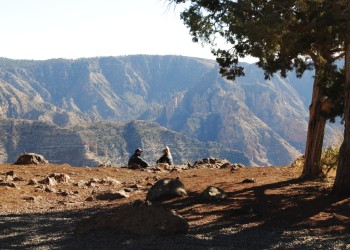
The trail forms a loop with access at several points along it. The southern and eastern portions of the loop follow the rim of Sycamore Canyon. The northern and western sections travel through ponderosa pine forests. The entire loop may be traveled from any of the trailheads, or hike a segment of the trail by shuttling between trailheads. Watch for rock cairns and small signs.
Sycamore Falls is a popular rock climbing area. Climbing is a potentially dangerous activity. A variety of skills and techniques are required to ensure a safe climbing experience. Please seek instruction from qualified sources before venturing onto the cliffs.
Sycamore Rim Trail - Recreation Opportunity Guide & Map
Specific Trail Information
Trail Number
Trail Type
General Information
None.
No motorized vehicles. Due to a few steep, rocky areas around Pomeroy Tanks and Sycamore Falls, the use of horses is not recommended for this portion of the trail.
Getting There
Trailhead/Starting Points
Forest Road 56
Dow Spring
Vista Point
Sycamore Falls
Pomeroy Tanks
Directions
From I-40 Garland Prairie exit #167 (approximately 9.4 miles):
- Begin south on E Garland Prairie Rd/Forest Road 146 and follow for approximately 7.6 miles,
- Turn right onto Forest Road 56 and follow for approximately 1.8 miles to the trailhead.
Other access points can be found on this map or on the Interactive Visitor Map
Road Condition: Paved and all-weather graveled roads suitable for sedans.
Recreation Opportunities
Recreation Groups
Established in 1935, this area contains a unique canyon-land environment.