
Fremont River Ranger District
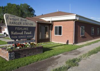
Address: 138 South Main Street Loa, UT 84747
Hours of Operation: Monday-Friday, 8am - 4:30pm (Closed on federal holidays)
Office Phone: (435) 836-2800
Mailing Address: PO Box 129 Loa, UT 84747
Additional Office Information
Overview
The Fremont River Ranger District covers the southeast portion of the Fishlake National Forest, which also includes a portion of the Dixie National Forest, once known as the Teasdale Ranger District. Combined, the district manages over 500,000 acres, including Fish Lake, the Thousand Lake Mountains, and Boulder Mountain. The Fremont Ranger District spans over four counties; Wayne, Sevier, Garfield, and Piute. The district office offers information for visitors, free travel maps and other brochures, firewood permits, Christmas tree permits and a variety of other public services.
Numerous motorized trails and roads on the Fremont River Ranger District provide riders an opportunity to experience the area, as well as connect with trails to other areas. Hiking trails, campgrounds, lakes and reservoirs, and streams allow visitors to enjoy a variety of outdoor experiences. The Fish Lake-Johnson Valley areas are a popular spot on the Fishlake, and receive 25 percent of the recreation use on the Forest. The area is home to elk, deer, and black bear, as well as other species of animals.
Highest point on the district:
-Fish Lake Hightop - 11,633 feet elevation
Lowest point on the district:
-Unnamed wash at crossing of U-24 and Capitol Reef National Park boundary - 6,380 feet elevation
Lakes & Reservoirs
-Fish Lake - 2,500 acres
-Forsyth Reservoir - 171 acres
-Johnson Valley Reservoir - 700 acres
-Mill Meadow Reservoir - 156 acres
Major Drainages
Colorado River Basin
-Fremont River
-Sevenmile Creek
-UM Creek