
Lower Box Creek Trailhead
Overview
The Lower Box Creek Trailhead is located at an elevation of over 7,000 feet in a canyon along Greenwich Creek with cottonwood trees for shade.
Natural Features
Lower Box Creek Trailhead is located within a beautiful canyon with cottonwood trees, red rock mountains and mixed brush around the area.
Facilities
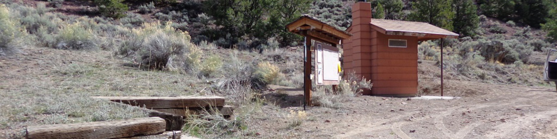
This site has a vault toilet, a small dirt surface parking area, information kiosk and a couple of picnic tables.
Recreation
Dispersed camping, OHV riding, hiking, horseback riding, hunting, stream fishing and wildlife viewing are fun activities available nearby. Paiute Side Trails 33 and 53 begin at the trailhead and are open to vehicles 50 inches or less in width. Please stay on designated routes and pack-out what you pack-in.


General Information
March - November
Open 24 hours/day
- All motorized travel is restricted to designated travel routes. Cross country travel, driving around closed gates and width restriction barriers, and driving on meadows is prohibited.
- Pack out all trash and follow leave no trace principles.
- Use designated vault toilet to protect natural environment and wildlife.
- Use existing site and park only on durable surfaces (not vegetation).
- Avoid creating new trails.
- All OHVs are required to be registered and display a permit or sticker for riding on public lands.
- Yield to hikers, horses and non-motorized use
No fees are required for this site
- Clean up dog waste and dispose of it properly.
- Keep dogs from chasing, harassing, and disturbing wildlife, livestock or other visitors.
- Yield to other hikers, horses, and other trail users by stepping off the trail and controlling your dog.
- Pets must be leashed at all times within this recreation area. This policy is in place to ensure the safety and enjoyment of all visitors and to protect wildlife.
Address: 115 East 900 North Richfield, UT 84701
Phone: (435) 896-9233
Hours: Monday - Friday, 8am - 4:30pm (Closed on federal holidays)
Getting There
Latitude / Longitude
Latitude: 38.46853889
Longitude: -111.9925389
Directions
Lower Box Creek Trailhead is located about 3 miles west of Greenwich Utah. From Greenwich take UT-62 north for 0.5 miles and turn left (west) onto the Lower Box Creek Road (FR069) for 1.2 miles. Turn left onto FR195 for 1.5 miles to the trailhead. See the link below for directions.
Parking
Small dirt parking area
Facility and Amenity Information
Restrooms
Restrooms are available at this site.
Water
Potable water is not available at this site.
Picnic Tables
Picnic tables are available at this site.
2 tables are available for day use at this location
Horse/Pack Animal Information
Horse/Pack animals are allowed at this site.
Please stay on designated trails.
Use weed-free hay to prevent the spread of invasive plant species.
Tie horses to trees in a way that won't damage the tree.
Recreation Opportunities
OHV Trail Riding Info
OHV trails departing from this trailhead are limited to vehicles 50 inches or less in width.