
Big Falls Trail 1E13
The trailhead is reached by turning east off Highway 38 to Valley of the Falls Road in Forest Falls. Continue through the community to the top end of the road.
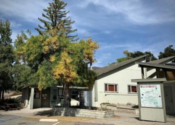
Big Falls trailhead will be the first main parking lot on the left, immediately before the picnic area.
Walk down the creek area about 5 minutes, then cross the wash (it is not recommended to cross when the water flow is high or when thunderstorms are predicted) and go up the trail about one tenth of a mile to the waterfall overlook.
This area provides an excellent view of one of the tallest waterfalls in southern California.
Do not hike/climb past the overlook! It is very DANGEROUS because of the loose, slippery, and steep terrain.

Specific Trail Information
Trail Number
Trail Type
General Information
Recreation Passes Honored: Adventure Passes, Digital Recreation Pass or Interagency Recreation Passes.
You can purchase your Recreation Passes at FS Offices and select Vendor Locations. Please call ahead for pass availability.
Upper Big Falls is currently closed until May 22, 2026 to provide for public safety. See Forest Order 05-12-53-25-01. The closure is from the observation deck up to the waterfalls itself. Do not hike/climb past the observation deck.
Dogs MUST be on a leash not longer than six feet, or otherwise under physical restrictive control [36 CFR 261.16(j)]. Read more info about pet ethics.
Address: 34701 Mill Creek Road Mentone, CA 92359
Phone: (909) 382-2882
Hours: Saturday-Sunday 9:00 am to 4:00 pm (Closed on federal holidays)
Getting There
Directions
The trailhead is reached by turning east off Highway 38 to Valley of the Falls Road in Forest Falls. Continue through the community to the top end of the road. Big Falls trailhead will be the first main parking lot on the left, immediately before the picnic area.
Latitude 34.082328
Longitude -116.893432
Elevation 5791 - 6017
Distance .29 miles
Difficulty Easy
Additional Information
Operated By
USDA Forest Service