
Cucamonga Peak Trail 7W04
Hiking at high elevations (Cucamonga Peak, Ice House Canyon, San Gorgonio Peak, etc..) in winter, spring and even early to mid-summer requires experienced mountaineering skills and IS NOT recommended for those unprepared for extreme conditions that can change very quickly.
The most accessible trailhead to access Cucamonga Peak is on the Angeles National Forest. Visit their website, Icehouse Canyon Saddle via Icehouse Canyon or call the Mt. Baldy Visitor Center (909) 982-2829 to get current information for that trail.
A second option to access Cucamonga Peak is via the Middle Fork Trail 6W01. This trailhead is located on FSR 2N58 (Middle Fork Road), which is unpaved and high-clearance vehicles are highly recommended. This road closes to vehicle traffic seasonally and during high fire restrictions – Please call the LCRS for current closures or check the Alerts & Notices – Forest Orders section of this website.
A third option to access Cucamonga Peak is from the Joe Elliot Yellow Post Sites, located near the end of FSR 1N34 (San Sevaine Road). This road closes to vehicle traffic seasonally and during high fire restrictions – Please call the Lytle Creek Ranger Station for current closures or check the Alerts & Notices – Forest Orders section of this website. The portion of the trail from Joe Elliott to the peak is best for experienced hikers only as it is steep, rocky, exposed, and not maintained. **Please note that the map below reflects this third trailhead option.
A Wilderness Permit is required if accessing trails on the San Bernardino National Forest.
Specific Trail Information
Trail Number
Trail Type
Accessibility
Vault toilet at Icehouse Canyon and Middle Fork Trailheads
General Information
Recreation Passes Honored: Adventure Passes, Digital Recreation Pass or Interagency Recreation Passes.
You can purchase your Recreation Passes at FS Offices and select Vendor Locations. Please call ahead for pass availability.
A Wilderness Permit is required if accessing trails on the San Bernardino National Forest. A permit can be obtained via online using the SGWA.org site.
- No in-person permits available at Ranger Station MUST obtain via online.
- Wilderness Permit order
- Group sizes limited to 12 people and 8 stock animals
- No ground fires or building of rock-fire-rings permitted anywhere on Southern CA Forests! The use of propane or gas appliances allowed with a valid CA campfire permit.
- Dogs MUST be on a leash not longer than six feet, or otherwise under physical restrictive control [36 CFR 261.16(j)]. Read more info about pet ethics.
- Pack It In/Pack It Out. Pack out what you pack in and Leave no Trace!
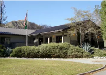
Address: 1209 Lytle Creek Road Lytle Creek, CA 92358
Phone: (909) 382-2851
Hours: Wednesday-Sunday from 8:00 am to 4:30 pm, Monday & Tuesday Closed
Getting There
Directions
Latitude 34.219066
Longitude -117.552830
Elevation 4962 - 8862
Distance 8.4 miles
Difficulty Strenuous
Additional Information
Operated By
USDA Forest Service