
Pacific Crest Trail 2000 White Pass
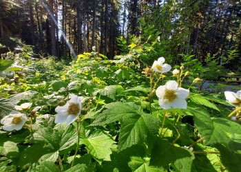
White Pass, elevation 5,904 feet, is known for its magnificent greenery in every direction. The scenery along this section of the Pacific Crest Trail is remarkable. From White Pass the trail continues north up over Red Pass, down into the upper Whitechuck valley, and up along the flanks of Glacier Peak to Fire Creek Pass. The trail then drops 3,000’ into Milk Creek before climbing to meadows then dropping almost 4,000’ to the Suiattle River. Camping is available at many locations along the way, including Glacier Peak Meadows, East Fork Basin and Vista Creek. At Vista Creek the newly relocated (completed in 2011) section of the trail heads northwest to cross the Suiattle River at a new bridge, just upstream of Canyon Creek. After crossing, the river the trail continues easterly along the Suiattle River and Miners Creek to Suiattle Pass.
Specific Trail Information
Trail Number
General Information
A valid Recreation Pass is required for each vehicle parked at the trailhead.
- Not passable to stock at this time (Fall 2011).
- Backcountry stoves are strongly recommended due to the limited amount of down and dead wood and the fragile alpine area.
- Campers are asked to camp at established camping areas.

Address: 1405 Emens Avenue North Darrington, WA 98241
Phone: (360) 436-1155
Hours: This U.S. Department of Agriculture office is currently closed due to the lapse in Federal Government funding. The office will reopen once Congress restores funding. (Closed on federal holidays)
Getting There
Directions
There are numerous trails that access the Pacific Crest Trail from the Darrington Ranger District. Check current conditions for access:
- North Fork Sauk 649 – 8.4 miles to PCT
- Pilot Ridge Trail 652 – 11.8 miles to PCT
- Bald Eagle Trail 650 – 9.5 miles to PCT
- Suiattle River Trail 784 – 10.8 miles to PCT
There are also several ways to access the PCT from the south:
- Via the North Fork Skykomish Road #63
- North Fork Skykomish Trail 1051 Via road #63
- West Cady Ridge Trail 1053 via road #63
Or from the east:
- Little Wenatchee River Trail 1525 via Little Wenatchee Road #283
- Indian Creek Trail 1502 via road #64
- Suiattle Pass Trail 1279 via Railroad Creek/Lake Chelan
Recreation Groups
The northern section of the Pacific Crest National Scenic Trail is rugged and it is the wettest section along the entire route. Make sure to plan ahead and be prepared.