
Eagle Cap Wilderness
The Eagle Cap Wilderness lies in the heart of the Wallowa Mountains in northeastern Oregon on the Wallowa-Whitman National Forest. This country was first occupied by the ancestors of the Nez Perce Indian Tribe in 1400 A.D. and later the Cayuse, the Shoshone and Bannocks. The Eagle Cap Wilderness itself was used as hunting grounds for bighorn sheep and deer, to gather huckleberries and was the summer home to the Joseph Band of the Nez Perce tribe. 1860 marked the year the first settlers moved into the Wallowa Valley.
In 1930, the Eagle Cap was established as a primitive area. It was designated as wilderness in 1940. The Wilderness Act of 1964 placed the area in the National Wilderness Preservation System. It now totals 359, 991 acres.
The Eagle Cap Wilderness is characterized by high alpine lakes and meadows, bare granite peaks and ridges, and U-shaped glaciated valleys. One is constantly reminded that nature operates on her own terms with her own rhythms that may not match our structural lives. Each season comes and goes bringing with it new challenges and adventures.
We truly hope you will find these experiences here and carry with you a memory that will last a life time. These memories can only be left to future generations when we all take part in an effort to respect and care for wilderness. Doing your part is vital to the future of Eagle Cap.
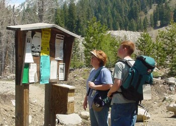
Please plan your trip carefully, know the current regulations and follow minimum impact practices. Seek specific information from your nearest forest office.


General Information
Recreation Opportunities
Hikers and horseback riders can choose from approximately 535 miles of trails in the Eagle Cap Wilderness. Trailheads are located on all sides of the wilderness, with access from the counties of Wallowa, Union, and Baker. Upon entrance to the wilderness visitors are taken back to a time when travel was without automobiles, bicycles and before the luxury of mechanized equipment.
Winter months bring heavy snowfall to the Eagle Cap Wilderness area, causing many of the trails in the wilderness to be blocked with snowbanks through June and early July. The summer and fall season typically begins at the end of June on the lower elevation trails and runs to the end of November. High elevation trails are usually snow free from mid-July through September. Visitors should plan to check with the Wallowa Mountains Visitor Center to be sure your route of travel is accessible. Always come prepared with an ax and shovel for unexpected trail damage or down trees.
The Eagle Cap Wilderness is the most heavily used wilderness in northeast Oregon, with the Lakes Basin Management Area the most popular. With the large size of the wilderness and the extensive trail system visitors should find many opportunities for solitude. Solitude is an important part of a wilderness adventure. To assure yourself of this atmosphere avoid holidays, travel on a weekday, in early spring or after Labor Day, and visit areas other than the Lakes Basin.
Listed below are trails of high use which visitors may want to avoid during the peak season:
- The Lakes Basin (includes the following lakes: Minam, Blue, Upper, Mirror, Sunshine, Moccasin, Glacier, Prospect, Pocket, Frazier, Little Frazier, Douglas, Crescent, Craig, Lee, Lilly, Razz, Horseshoe, Unit, and Ice.)
- East Fork Wallowa
- West Fork Wallowa
- Hurricane Creek
- East Fork Lostine
- West Fork Lostine
All wilderness visitors to the Eagle Cap Wilderness must obtain a Wilderness Visitor Permit before entering the area.
Some trailheads require a valid recreation pass. Check our Recreation Pass and Permits page for details.
- You will need to display a valid day pass (or annual pass) for each day your vehicle is at a recreation site where a fee is required.
Wilderness Regulations and Weed-Free feed requirements apply.
Getting There
Directions
The Eagle Cap Wilderness lies five miles southwest of Enterprise and Joseph, Oregon; 25 miles east of La Grande, Oregon; and 20 miles north of Halfway, Oregon.
Main Access Points
Major Trailheads from the Enterprise, Oregon side
- Two Pan Trailhead - Minam Lake Trail #1670 and Murphy Creek Trail #1672.
- Bowman-Francis Lake Trailhead - Bowman Trail #1651 and Frances Lake Trail #1663.
- Maxwell Lake Trailhead- Maxwell lake Trail #1674.
- Hurricane Creek Trailhead - Hurricane Trail #1807.
- Wallowa Lake Trailhead- West Fork #1820 and East Fork #1804 Wallowa Trails.
- Tenderfoot/Big Sheep Creek Trailhead- Tenderfoot Wagon Road Trail #1819.
- Indian Crossing Trailhead- South Fork Imnaha Trail #1816.
Major Trailheads from the La Grande, Oregon side
- Moss Springs Trailhead- Lackeys Hole Trail #1942 and Horse Ranch #1908.
- North Fork Catherine Creek Trailhead- North Fork Catherine Creek Trail #1905.
- West Eagle Meadows Trailhead- West Eagle Trail #1934.
Major Trailheads from the Halfway, Oregon side
- Main Eagle Trailhead- Main Eagle Trail #1922.
- East Eagle Trailhead- East Eagle Trail #1910.
- Cornucopia Trailhead - Blue Creek Trail #1865.
- Twin Lakes Trailhead - Hells Canyon National Recreation Area- Twin Lakes Trail #1874.
- Summit Point Trailhead - Cliff Creek Trail #1885.
Maps
Topo Maps
Aneroid Mountain, Bennet Peak, Chief Joseph, China Cap, Cornucopia, Deadman Point, Eagle Cap, Eagle Cap, Flagstaff Butte, Fox Point, Jim White Ridge, Joseph, Krag Peak, Lick Creek, Little Catherine Creek, Lostine, Minam, Mount Fanny, Mount Moriah, North Minam Meadows, Steamboat Lake. Download free U.S. Forest Service Topo maps.
Wilderness.net
Go to Wilderness.net for online maps and other important Wilderness information.
Facility and Amenity Information
Restrooms
Restrooms are not available at this site.
Water
Potable water is not available at this site.