
Main Eagle Trailhead
A walk in the wilderness is only part of the attraction at Main Eagle Trailhead. The scenic views of rockslides, peaks and glacial valleys along the Wild and Scenic Eagle Creek add to the beauty of the site. For those desiring a short hike to a scenic waterfall - cross the log bridge and keep walking! Copper Falls is only two miles in.
The Main Eagle Trailhead is located on the edge of the Eagle Cap Wilderness and adjacent to the Wild and Scenic Eagle Creek. Choose to hike or ride horseback to one of several wilderness lakes, or spend your day fishing and exploring along the water’s edge.
The Main Eagle Creek trail #1922 links to hundreds of other miles of wilderness trails from this site. Two Color Campground and Boulder Park Campground are close by.
Printable map and information sheet about trails 1922 & 1937 (PDF File)


General Information
Open 24 hours/day
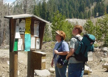
All visitors to the Eagle Cap Wilderness must obtain a Wilderness Visitor Permit before entering the area. Only one permit is required per group and there is no fee for the permits. Registration and Permit boxes are located at each trailhead near the information board. The permits are self-issued.
Recreation Passes may be used as a form of fee payment.
- You will need to display a valid day pass (or annual pass) for each day your vehicle is at a recreation site where a fee is required.
General rules of use and restrictions apply for this developed recreation site. Wilderness Regulations apply within Eagle Cap Wilderness.
- Motorized vehicles, bicycles, carts, hang glider and other mechanical equipment is prohibited in the Wilderness area.
Day Use:
$5 per vehicle per day
$30 per annual
$5/vehicle/day, or Northwest Forest Pass, or any form of the America the Beautiful National Pass
Getting There
Latitude / Longitude
Latitude: 45.068052
Longitude: -117.406764
Elevation
4925
Directions
From Baker City, Oregon head north on Interstate 84 for 5 miles to exit 298; turn right off interstate to State 203 Highway and travel 18 miles to Big Creek Road at Medical Springs; In Medical Springs turn right on Big Creek Road and go 1.5 miles to Forest Service Road (FSR) 67 and turn left; Travel on FSR 67 for about 14 miles; Turn left on FSR 77 for 0.5 miles and then turn right onto FSR 7755 to go up Eagle Creek; The trailhead is about 4 miles past the turnoff.
From La Grande, Oregon go approximately 25 miles southeast on Oregon State 203 to Medical Springs; In Medical Springs turn left on Big Creek Road and go 1.5 miles to Forest Service Road (FSR) 67 and turn left; Travel on FSR 67 for about 14 miles; Turn left on FSR 77 for 0.5 miles and then turn right onto FSR 7755 to go up Eagle Creek; The trailhead is about 4 miles past the turnoff.
Parking
4-5 vehicles with trailers
Facility and Amenity Information
Restrooms
Restrooms are available at this site.
Water
Potable water is not available at this site.