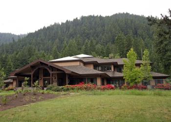
Sacandaga Campground
Situated within an old-growth forest on a terrace above the Middle Fork of the Willamette River, this 17 site family-friendly camp is generally quiet even on weekends during the height of the recreation season.
The Middle Fork National Recreation Trail passes near the camp and offers adventures for hikers, equestrians, and off-road cyclists. Campers can explore two access trails that lead from the camp down to the Middle Fork of the Willamette River.
Fishing Regulations & Information: Oregon Department of Fish and Wildlife manages fishing regulations. Visit their website for information on fishing seasons and fishing licenses.
Reservations
General Information
May - September
Check in: 2:00 p.m.; Check-out: 12:00 p.m.; Quiet hours are 10:00 p.m. until 6:00 a.m.
Interagency Senior and Access Passes (and the Golden Age and Access Passes) may receive a 50% discount on the use fee for individual campsites. This discount does not apply to extra vehicle fee or multiple campsites.
- Non street-legal OHV use prohibited in the campground
- Camping is not allowed more than 14 days in a 60 day period.
- Check-in time: 2:00 pm or later. Check-out time: 1:00 pm
- Use of chainsaws in the campground is prohibited
- Dogs MUST be on leash at all times within the campground
Overnight Use:
Single Site: $14 per night
Additional Vehicle Fee: $6 per vehicle per night
- Single campsite: $14 (single campsite capacity: 6 persons, 2 vehicles, 2 tents)
- Extra vehicle: $6 per vehicle, per night
Campsite must be occupied every night paid, and fees must be paid within 30 minutes of arrival. Download the Recreation.gov mobile app prior to your trip so you can pay the overnight fee onsite with Scan and Pay.
Within developed recreation sites, dogs must be on a leash no longer than 6 feet, or otherwise under physical restrictive control. 36 CFR 261.16(j)
Address: 46375 Highway 58 West Fir, OR 97492
Phone: (541) 782-2283
Hours: Monday-Friday, 10:00 a.m. - 4:30 p.m. (Closed on federal holidays)
Office Email: sm.fs.mfrd@usda.gov
Getting There
Latitude / Longitude
Latitude: 43.49638889
Longitude: -122.3283333
Directions
Located 27 miles southeast of Oakridge, Oregon, on the Middle Fork of the Willamette River.
From Oakridge, Oregon: From the junction of Crestview Street and Oregon State Highway 58 (at the only traffic light along Highway 58 in Oakridge), proceed east on Highway 58 for 1.7 miles. Turn right onto Hills Creek Road/Kitson Springs Road. Travel for 0.5 miles and turn right onto Forest Road 21. Follow Forest Road 21 for 24.6 miles and the destination will be on your right.
Facility and Amenity Information
Restrooms
Restrooms are available at this site.
Water
Potable water is not available at this site.
Picnic Tables
Picnic tables are available at this site.
Horse/Pack Animal Information
Horse/Pack animals are not allowed at this site.


