

Tamolitch Falls (Blue Pool) #3507
The beauty of Tamolitch Falls (also known as Blue Pool) has always made it a popular spot. This cliff-rimmed basin was renamed “Tamolitch,” in 1933 by William Parke, a recreational engineer for the Willamette National Forest, inspired by the Chinook jargon word for “bucket.” Although the flow of the falls is typically only seen in spring, the pool continues to be fed by underground springs. Today, this rocky section of the McKenzie River National Recreation Trail from Trail Bridge Reservoir north along the McKenzie River and the stunningly clear water of the pool draw hundreds of hikers, photographers and mountain bikers.
A lava flow from Belknap Crater 1,600 years ago buried a 3 mile (4.8 km) stretch of the McKenzie River between Carmen Reservoir and Tamolitch Falls. The river resurfaces at Blue Pool at the base of dry Tamolitch Falls, seeping up to the surface through the porous lava, creating a pristine turquoise blue colored pool. The water, a chilly 37 degrees Fahrenheit (2.8 C) on average, reflects the surrounding cliffs covered with alder and evergreen trees. While the falls are dry the majority of the time, during wet winters the river can flood over the lava bed and Tamolitch Falls will flow.
With the popularity of Blue Pool, please help protect this area and preserve the experience for you and for future visitors. Practice Leave No Trace Principles during your visit. There are no services or facilities such as garbage or restrooms so please pack-it-in pack-it-out.
While it is a relatively short hike, the rough, rocky terrain can be challenging so sturdy, closed-toed footwear is recommended.
- Length: From Carmen Smith Reservoir (3.3 miles); from Trail Bridge Reservoir (2.1 miles)
- Elevation: begins at 2,200 feet elevation and ends at 2,450 feet elevation (south to north)
- Difficulty: Moderate
Safety Information:
The steep cliffs surrounding the pool are 10-60 feet tall and the average water temperature is 37 degrees Fahrenheit. While it is not against the rules to jump in, people have been severely injured or died at this site in the past. There is minimal to zero phone reception in the area and it can take hours for emergency responders to arrive.
Photo Gallery


General Information
Close To:
- McKenzie River National Recreation Trail
- Clear Lake
- Sahalie and Koosah Falls
- Trail Bridge Campground
- Paradise Campground
- Ice Cap Campground
Day use only: open 6:00 a.m. to 10:00 p.m.
- Trail closed to motorized vehicles and stock.
- Mountain bikers: yield to hikers, expect congestion, and use caution through the rough, rocky terrain. Mountain bikers should use the bypass trail to avoid congestion and user conflicts.
- Forest Service Road 2600-740 off Highway 126 and surrounding area is closed to vehicle and pedestrian traffic. No parking is allowed. A Forest Protection Officer will contact any unauthorized person with a vehicle that is parked in the closure area. Any repeat violators will be issued a Violation Notice. Any persons who refuse to leave the closed parking area, or who refuse to identify themselves, can be subject to arrest.
No fees are required for this site
Within developed recreation sites, dogs must be on a leash no longer than 6 feet, or otherwise under physical restrictive control. 36 CFR 261.16(j)
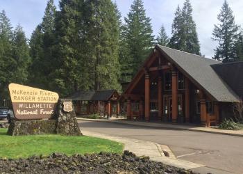
Address: 57600 McKenzie Highway McKenzie Bridge, OR 97413
Phone: (541) 822-3381
Hours: Monday-Friday, 10:00 a.m. - 4:30 p.m. (Closed on federal holidays)
Office Email: sm.fs.mf@usda.gov
Getting There
Latitude / Longitude
Latitude: 44.2907
Longitude: -122.03537
Elevation
2450 feet
Directions
The trail to Tamolitch Falls/Blue Pool can be accessed from Carmen Smith Reservoir (3.3 miles north) or from McKenzie River Trailhead: Tamolitch Falls/Blue Pool (2.1 miles south).
Directions to McKenzie River Trailhead: Tamolitch Falls/Blue Pool: From the McKenzie River Ranger Station, take Highway 126 east 10 miles to Trail Bridge Reservoir. Turn left on Forest Service Road (FSR) 730 (at the sign to Trail Bridge Reservoir). Cross the river and turn right on FSR 2672-655, travel ½ mile to parking area. Walk slightly uphill up the road to trailhead sign, begin walking upstream.
Travel Considerations
If the parking lot is full, do not park along Highway 126 or in front of EWEB Facilities and access points.
Facility and Amenity Information
Restrooms
Restrooms are available at this site.
Water
Potable water is not available at this site.
Picnic Tables
Picnic tables are not available at this site.
Horse/Pack Animal Information
Horse/Pack animals are not allowed at this site.