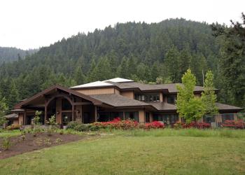
Timpanogas Campground
This small, high-elevation 10 site campground sits at 5,300 feet at the far southeast end of the district, surrounded by fine stands of silver, grand, and noble fir. Be prepared for mosquitoes from July through August.
Summer recreation includes hiking, viewing, horseback riding, fishing and camping. The Timpanogas Basin offers 23 miles of hiking trails with excellent views of Diamond Peak, Sawtooth and Cowhorn Mountains. Winter recreation offers many marked snowmobile routes and a shelter across the lake, as well as spring cross-country skiing.
Timpanogas Lake is the headwaters of the Middle Fork of the Willamette River. Only non-motorized boating is allowed, and anglers typically have success with cutthroat and brook trout.
Active Alerts
Reservations
Make Reservations HereGeneral Information
June - Late October, weather dependent
Check in: 2:00 p.m.; Check-out: 12:00 p.m.; Quiet hours are 10:00 p.m. until 6:00 a.m.
Interagency Senior and Access Passes (and the Golden Age and Access Passes) may receive a 50% discount on the use fee for individual campsites. This discount does not apply to extra vehicle fee or multiple campsites.
- Camping is not allowed more than 14 days in a 60 day period.
- Check-in time: 2:00 pm or later. Check-out time: 1:00 pm
- Use of chainsaws in the campground is prohibited
- Dogs MUST be on leash at all times within the campground
Overnight Use:
Single Site: $14 per night
Additional Vehicle Fee: $6 per vehicle per night
- Single Campsites - $14 per night
- Extra Vehicles - $6 per vehicle, per night
Campsite must be occupied every night paid, and fees must be paid within 30 minutes of arrival. Download the Recreation.gov mobile app prior to your trip so you can pay the overnight fee onsite with Scan and Pay.
Within developed recreation sites, dogs must be on a leash no longer than 6 feet, or otherwise under physical restrictive control. 36 CFR 261.16(j)
Address: 46375 Highway 58 West Fir, OR 97492
Phone: (541) 782-2283
Hours: Monday-Friday, 10:00 a.m. - 4:30 p.m. (Closed on federal holidays)
Office Email: sm.fs.mfrd@usda.gov
Getting There
Latitude / Longitude
Latitude: 43.410272
Longitude: -122.115253
Directions
Approximately 42 miles southeast of Oakridge, Oregon, in the Oregon Cascades Recreation Area (Douglas County)
From Oakridge, Oregon: From the intersection of Crestview Street and Oregon State Highway 58 (at the only traffic light along Highway 58 in Oakridge), proceed east on Highway 58 for 1.7 miles. Turn right onto HIlls Creek Road/Kitson Springs Road. Travel for 0.5 miles and turn right onto Forest Road 21. Travel for approximately 32 miles (past Indigo Springs Campground) until the junction with Forest Road 2154. Turn left onto Forest Road 2154 and travel approximately 8 miles (past the end of pavement) to the campground.
Facility and Amenity Information
Restrooms
Restrooms are available at this site.
Water
Potable water is available at this site.
Picnic Tables
Picnic tables are available at this site.
Horse/Pack Animal Information
Horse/Pack animals are not allowed at this site.


