
Santiam Airstrip Snow Trail
Ikenick Sno-Park » Santiam Airstrip Trail
This route begins at the Little Nash Sno-Park and travels southward along Forest Service Road 2676 for approximately 2.5 miles.
It then heads eastward on the old Santiam Wagon Road for another 4.8 miles, ending at the junction with the Sand Mountain Loop at Big Lake.
CAUTION: Santiam Airstrip is an operational landing field.
General Information
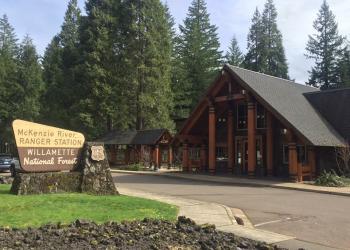
Address: 57600 McKenzie Highway McKenzie Bridge, OR 97413
Phone: (541) 822-3381
Hours: Monday-Friday, 10:00 a.m. - 4:30 p.m. (Closed on federal holidays)
Office Email: sm.fs.mf@usda.gov
Getting There
Trailhead/Starting Points
Access Santiam Airstrip Trail from Little Nash Sno-park.
Directions
From McKenzie Bridge, OR, drive 28 miles northeast on Highway 126.
After merging with Highway 20, take a right south into Little Nash Sno-Park