
Shut-In Trail (NRT)
16.3 mi - Difficult - The Shut-in Trail was probably named for the thick rhododendron thickets that make the hiker feel "shut in". George Vanderbilt constructed it in the 1890’s for the purpose of reaching his Buck Spring Hunting Lodge from the Biltmore House. (The remnants of the lodge are near the Buck Spring Gap Overlook.) Since that time, this route has been converted to a hiking trail, and is now a part of the Mountains-to-Sea Trail (#440, white dot blazes). In 16.3 miles, the trail changes elevation almost 3,000 feet, and in places can be quite challenging. Except where the trail crosses the Parkway, it is a quiet walk through beautiful hardwood forests with many nice views of the valleys below. Despite its proximity to the Parkway, this trail does not receive much use, particularly along its southern reaches.
Approximate Elevation Change: 2,700 feet
Blaze: White
Specific Trail Information
Trail Number
Trail Type
General Information
Year-round
Hiking Trail: foot traffic only.
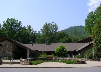
Address: 1600 Pisgah Highway Pisgah Forest , NC 28768
Phone: (828) 877-3265
Hours: Peak Season Hours (April 1-Nov. 15) 9 AM-5 PM daily; Off-season Hours (Nov. 16-March 31) 9 am-5 pm M-F (Closed on federal holidays)
Office Email: sm.fs.pisgahrd@usda.gov
Getting There
Directions
Leaving the Pisgah District Ranger Station/Visitor Center, turn right (north) onto US 276. Proceed north 14 miles to the Blue Ridge Parkway, and then 4.2 miles north on the Parkway, to MP 407.6, just beyond the Pisgah Inn. Here two connected parking areas serve the Buck Spring Gap Overlook and then the Mount Pisgah trailhead. The Shut-In Trail starts at the steps at the northern end of the overlook’s parking area, but a large sign on the right side of the Mount Pisgah parking area’s southern end provides a more prominent access point. There are many additional access points along the Blue Ridge Parkway; wooden posts with a white hiker symbol mark these crossings. The trail ends near the French Broad River, at the Parkway’s entrance/exit ramp for NC 191; paved, roadside parking is available there.
Check Blue Ridge Parkway road status by visiting https://www.nps.gov/blri/planyourvisit/roadclosures.htm
Additional Information
Operated By
US Forest Service