
Recreation
View the Recreation opportunities, sites, trails, and areas on the Gifford Pinchot National Forest.
The Gifford Pinchot National Forest has many areas and places to explore through hiking, biking, climbing, fishing, hunting, snow sports, and many others.

This area is located in the Northern most portion of the Gifford Pinchot National Forest in southwest Washington, and comprises about 575,000 acres.
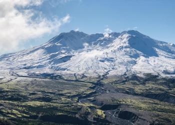
The Mount St. Helens National Volcanic Monument and District contains many wonderful places to see and explore.

This area is located in the eastern portions of Gifford Pinchot National Forest in southwest Washington and comprises 367,000 acres.
View the many Recreation Groups on the Gifford Pinchot National Forest.

The Pacific Crest Trail within Gifford Pinchot National Forest begins in the Columbia Gorge and runs north to enter Gifford Pinchot National Forest just south of Wind River