
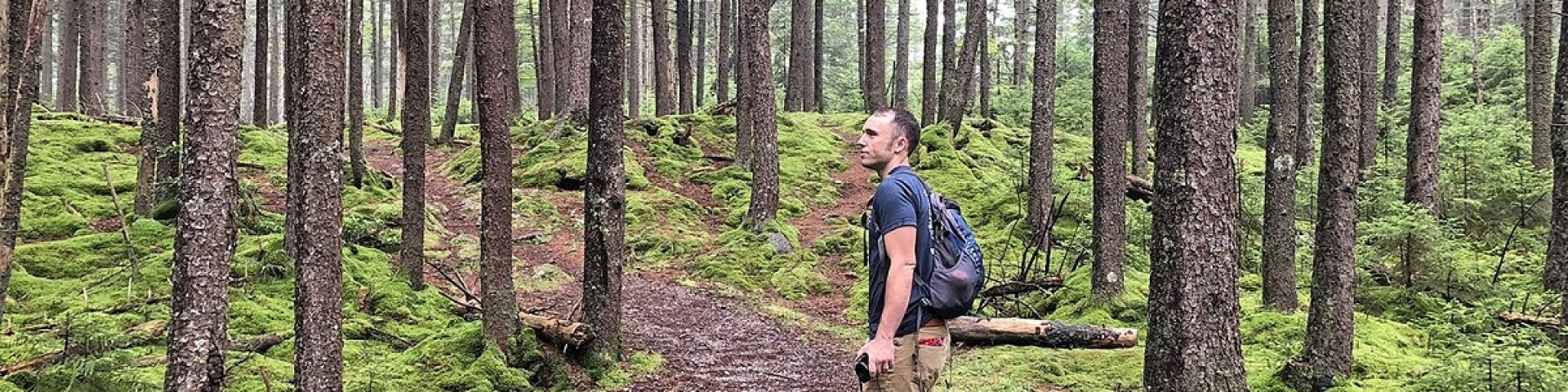
Recreation
The Monongahela National Forest is a recreation destination and major tourism attraction. The extensive backwoods road and trail system is available for hiking, mountain biking and horseback riding. There are many miles of railroad grades that are a link in the recreation use of the forest. Recreation ranges from self-reliant treks in the wildernesses and backcountry areas to the challenges of mountain climbing to traditional developed site camping. hunting, fishing, and wildlife viewing are also popular uses.
The national importance of the recreation resource of the Monongahela has been recognized through the designation of the Spruce Knob – Seneca Rocks National Recreation Area (NRA), the first NRA in the Forest Service, National Scenic Byway status for the Highland Scenic Highway, and eight Wilderness Areas.
Most of Monongahela National Forest is open year-round, closing only when access roads are snow-covered. But some developed campgrounds, picnic areas and both visitor centers routinely close from late fall through mid-spring. The following details the fall of 2025 closing dates.
Closing dates for recreation sites on the Cheat-Potomac Ranger District (304-478-2000) in the Elkins and Parsons areas:
- Bear Heaven Campground – Dec. 1
- Bickle Knob Observation Tower – Closes when roads are snow-covered.
- Horseshoe Recreation Area – Sept. 14
- Olson Observation Tower - Closes when roads are snow-covered.
- Stuart Recreation Area – Oct. 13
Closing dates for recreation sites on the Cheat-Potomac Ranger District (304-257-4488) in the Petersburg and Seneca Rocks areas:
- Big Bend Campground – Oct. 26
- Dolly Sods Picnic Area – Jan. 2
- Gatewood Group Campground – Dec. 1
- Jess Judy Group Campground – Oct. 26
- Red Creek Campground – Jan. 2
- Seneca Rocks Discovery Center – Oct. 27
- Seneca Rocks Picnic Area – Dec. 1
- Seneca Shadows Campground – Oct. 26
- Spruce Knob Lake – Closes when roads are snow-covered
- Spruce Knob Lake Campground – Oct. 13
- Spruce Knob Observation Tower – Area open year-round (except when roads are snow covered). Toilets close Dec. 2.
Closing dates for recreation sites on the Greenbrier Ranger District (304-456-3335) in the Bartow area:
- Gaudineer Knob Picnic Area – Closes when roads are snow covered. Toilets close Dec. 1.
- Island Campground – Dec. 1
- Lake Buffalo – Lake open year-round. Toilets close Dec. 1
- Laurel Fork Campground – Dec. 1
- Middle Mountain Cabins – Dec. 1
- Old House Run Picnic Area – Dec. 1
Closing dates for recreation sites on the Gauley Ranger District (304-846-2695) in the Richwood area:
- Big Rock Campground – Oct 31.
- Bishop Knob Campground – Sep. 2
- Cranberry Campground – Oct. 1
- Cranberry Mountain Nature Center – Oct. 15
- Cranberry River Developed Dispersed Campsites – Area closes when snow-covered. Toilets close Dec. 1.
- North Bend Picnic Area – Sep. 2
- Summit Lake – Lake open year-round. Toilets close Dec. 1
- Summit Lake Campground – Oct. 31
- Williams River Developed Dispersed Campsites (Sites #1 - #20 located downstream of Tea Creek Campground) – Area closes when snow-covered. Toilets closed Dec. 1.
- Woodbine Picnic Area – Sep. 2
Closing dates for recreation sites on the Marlinton-White Sulphur Ranger District (304-799-4334) in the Marlinton area:
- Day Run Campground – Oct. 31
- Highland Scenic Highway – Road closes when snow-covered.
- Pocahontas Campground – Sep. 2
- Rimel Picnic Area – Oct. 31
- Tea Creek Campground – Oct. 31
- Williams River Developed Dispersed Campsites (Sites #21 to #30 located upstream of Tea Creek Campground) – Area closes when snow-covered.
Closing dates for recreation sites on the Marlinton-White Sulphur Ranger District (304-536-2144) in the White Sulphur Springs area:
- Blue Bend Recreation Area – Oct. 31
- Lake Sherwood Recreation Area and Campground – Sept. 2 camping loops close; access to day boat launch is available year around
Roadside camping, also called dispersed camping, is available in many areas of the Forest year-round. For more information about recreation facilities, contact the District Office near the location you would like to visit. Contact information is listed at our offices page.

The Cheat Ranger District is located in Parsons, WV. Some of the district’s highlights include:
The Gauley Ranger District is located in Richwood, WV.
District Contact Information
The Marlinton Ranger District is located in Marlinton, WV.
Operational Hours:
The White Sulphur Ranger District is located in White Sulphur Springs, WV.