

Recreation

One of the premier areas for early spring wildflower viewing in the eastern Columbia River Gorge, Catherine Creek Recreation Area is popular each spring before it dries up

A massive formation of columnar basalt, Coyote Wall is one of the Columbia River Gorge's most recognizable features from all directions.
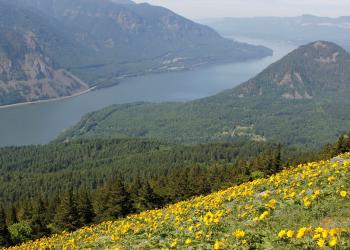
Dog Mountain Day Use Area and Trailhead is the access point for two of the most scenic trails in the Gorge, Do
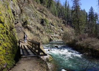
Eagle Creek is a historic site with accessible access for day use picnicking or hiking alongside the mouth of the stunning Eagle Creek slot canyon.

Constructed between 1913 and 1922, the original Columbia River Highway was designed to bring travelers to the most breathtaking sights and scenes in the Gorge.


Larch Mountain Picnic area is a wonderful day trip destination and a gateway to a beautiful view at Sherrard Point, day use picnicking, and several long hikes via Larch Mou

Multnomah Falls is one of the tallest year-round waterfalls in the United States and is the most visited natural recreation site in the Pacific Northwest.
