


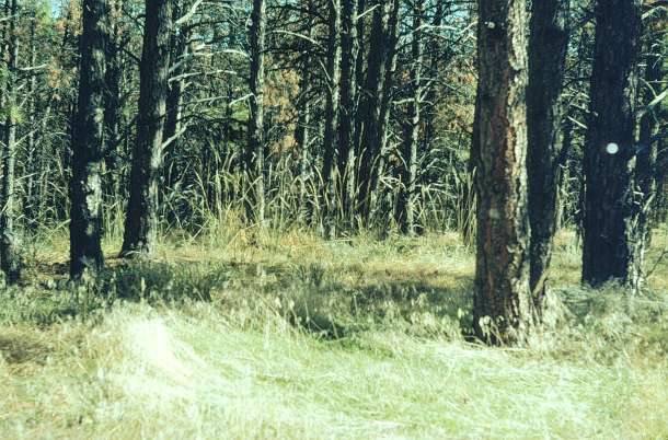
| Collection: | RMRS Archive Images |
| Location: | Arthur's Rock; CO; United States |
| Description: | Vegetation investigation. Arthur's Rock. Plot#1. Northwest corner to East. F-8. Plot established Sept. 1974 |
| Date: | 11/3/1976 |
| Collection: | RMRS Archive Images |
| Location: | Arthur's Rock; CO; United States |
| Description: | Vegetation investigation. Arthur's Rock. Plot-1. Northwest corner to East. F-6.5. Plot established Sept. 1974 |
| Date: | 11/3/1976 |

| Collection: | RMRS Archive Images |
| Location: | Arthur's Rock; CO; United States |
| Description: | Vegetation investigation. Arthur's Rock. Plot-1. North to South. F-8. Plot established Sept. 1974 |
| Date: | 11/3/1976 |

| Collection: | RMRS Archive Images |
| Location: | Arthur's Rock; CO; United States |
| Description: | Vegetation investigation. Arthur's Rock. Plot-1. North to South. F-6.5. Plot established Sept. 1974 |
| Date: | 11/3/1976 |

| Collection: | RMRS Archive Images |
| Location: | Arthur's Rock; CO; United States |
| Description: | Vegetation investigation. Arthur's Rock. Plot-2. North to South. F-6. Plot established Sept. 1974 |
| Date: | 11/3/1976 |

| Collection: | RMRS Archive Images |
| Location: | Arthur's Rock; CO; United States |
| Description: | Vegetation investigation. Arthur's Rock. Plot-2. North to South. F-5.6. Plot established Sept. 1974 |
| Date: | 11/3/1976 |

| Collection: | RMRS Archive Images |
| Location: | Arthur's Rock; CO; United States |
| Description: | Vegetation investigation. Arthur's Rock. Plot-2. North to South. F-6. Plot established Sept. 1974 |
| Date: | 11/3/1976 |

| Collection: | RMRS Archive Images |
| Location: | Arthur's Rock; CO; United States |
| Description: | Vegetation investigation. Arthur's Rock. Plot-4. North to South. F-8. Plot established Sept. 1974 |
| Date: | 11/3/1976 |

| Collection: | RMRS Archive Images |
| Location: | Arthur's Rock; CO; United States |
| Description: | Vegetation investigation. Arthur's Rock. Plot-4. North to South. F-6.5. Plot established Sept. 1974 |
| Date: | 11/3/1976 |

| Collection: | RMRS Archive Images |
| Location: | Arthur's Rock; CO; United States |
| Description: | Vegetation investigation. Arthur's Rock. Plot-4. North to South. F-8. Plot established Sept. 1974 |
| Date: | 11/3/1976 |

| Collection: | RMRS Archive Images |
| Location: | Arthur's Rock; CO; United States |
| Description: | Vegetation investigation. Arthur's Rock. Plot-2. North to South. F-5.6. Plot established Sept. 1974 |
| Date: | 11/3/1976 |

| Collection: | RMRS Archive Images |
| Location: | Arthur's Rock; CO; United States |
| Description: | Vegetation investigation. Arthur's Rock. Plot-3. South to North . F-5.6. Plot established Sept. 1974 |
| Date: | 11/3/1976 |

| Collection: | RMRS Archive Images |
| Location: | Arthur's Rock; CO; United States |
| Description: | Vegetation investigation. Arthur's Rock. Plot-3. South to North. F-5. Plot established Sept. 1974 |
| Date: | 11/3/1976 |

| Collection: | RMRS Archive Images |
| Location: | Arthur's Rock; CO; United States |
| Description: | Vegetation investigation. Arthur's Rock. Plot-3. South to North. F-6. Plot established Sept. 1974 |
| Date: | 11/3/1976 |

| Collection: | RMRS Archive Images |
| Location: | Arthur's Rock; CO; United States |
| Description: | Vegetation investigation. Arthur's Rock. Plot-3. South to North. F-5.6. Plot established Sept. 1974 |
| Date: | 11/3/1976 |

| Collection: | RMRS Archive Images |
| Location: | Arthur's Rock; CO; United States |
| Description: | Vegetation investigation. Arthur's Rock. Plot-3. Southwest to Northeast @ mid-plot. F-6. Plot established Sept. 1974 |
| Date: | 11/3/1976 |

| Collection: | RMRS Archive Images |
| Location: | Arthur's Rock; CO; United States |
| Description: | Mtn pine beetle infestations. Arthur's Rock Study Area. |
| Date: | 8/1975 |

| Collection: | RMRS Archive Images |
| Location: | Arthur's Rock; CO; United States |
| Description: | Mtn pine beetle killed ponderosa pine NW of Arthur's Rock (W. of Ft Collins.)White Pine Mtn [left] Buckhorn Mtn. [right] |
| Date: | 8/1975 |

| Collection: | RMRS Archive Images |
| Location: | Arthur's Rock; CO; United States |
| Description: | Beetle infested slab cut from ponderosa pine. Note blue stain. Slab taken to lab to measure beetle winter kill. Arthur's Rock. May 1973 |
| Date: | 5/1973 |

| Collection: | RMRS Archive Images |
| Location: | Arthur's Rock; CO; United States |
| Description: | Removing slab from ponderosa pine to determine winter kill in mountain pine beetles. Arthur's Rock. Colo. |
| Date: | 1973 |

| Collection: | RMRS Archive Images |
| Location: | Arthur's Rock; CO; United States |
| Description: | Two slabs removed from beetle infested ponderosa pine to measure winter mortality. Arthur's Rock. |
| Date: | 1973 |

| Collection: | RMRS Archive Images |
| Location: | Arthur's Rock; CO; United States |
| Description: | 1968 Mountain pine beetle (D. ponderosae) killed ponderosa pine in late July, 1969. Arthur's Rock. |
| Date: | 1969 |

| Collection: | RMRS Archive Images |
| Location: | Arthur's Rock; CO; United States |
| Description: | M.p. beetle killed p.p. Arthur's Rock. |
| Date: | 1969 |

| Collection: | RMRS Archive Images |
| Location: | Aurther's Rock; CO |
| Description: | M.p. beetle killed p.p. Aurther's Rock. |
| Date: | 1969 |