| Collection: | Pacific Northwest Research Station, Alaska Image Archive |
| Keywords: |
hydrology water conservation, soil conservation and erosion watershed management studies of infiltration, run-off and water erosion:effects of forestry practices (polluted water) |
| Location: | Alaska; Revillagigedo Island; Neets Bay |
| Description: | Soil pedestals formed in sandy loam. Neets Bay. |
| Date: | 7/1962 |
| Collection: | Pacific Northwest Research Station, Alaska Image Archive |
| Keywords: |
hydrology water conservation, soil conservation and erosion watershed management studies of infiltration, run-off and water erosion:effects of forestry practices (polluted water) |
| Location: | Alaska; Prince of Wales Island; Twelvemile Arm |
| Description: | Taken in 12 - mi. gravel quarry. Note the clay-silt deposit. Photo point: 71. |
| Date: | 9/30/1960 |
| Collection: | Pacific Northwest Research Station, Alaska Image Archive |
| Keywords: |
hydrology water conservation, soil conservation and erosion watershed management studies of infiltration, run-off and water erosion:effects of forestry practices (polluted water) |
| Location: | Alaska; Prince of Wales Island; Twelvemile Arm |
| Description: | Taken in 12 - mi. gravel quarry. View tries to show the depth (3-4") of muck deposited. Photo point: 71. |
| Date: | 9/30/1960 |
| Collection: | Pacific Northwest Research Station, Alaska Image Archive |
| Keywords: |
hydrology water conservation, soil conservation and erosion watershed management studies of infiltration, run-off and water erosion:effects of forestry practices (polluted water) |
| Location: | Alaska; Prince of Wales Island; Twelvemile Arm |
| Description: | Taken in 12 - mi. gravel quarry at a dry time. Note 2-3" of silt-clay deposits. Photo point: 71. |
| Date: | 9/30/1960 |
| Collection: | Pacific Northwest Research Station, Alaska Image Archive |
| Keywords: |
hydrology water conservation, soil conservation and erosion watershed management studies of infiltration, run-off and water erosion:effects of forestry practices (polluted water) |
| Location: | Alaska; Prince of Wales Island |
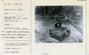
| Description: | This photo was made from a 4 x 5 neg. taken from an enlarged 35 mm color slide. |
| Date: | summer, 1960 |
| Collection: | Pacific Northwest Research Station, Alaska Image Archive |
| Keywords: |
hydrology water conservation, soil conservation and erosion watershed management studies of infiltration, run-off and water erosion:effects of forestry practices (polluted water) |
| Location: | Alaska; Prince of Wales Island; Harris River |
| Description: | Harris River, Spur 241. |
| Date: | 9/1/1959 |
| Collection: | Pacific Northwest Research Station, Alaska Image Archive |
| Keywords: |
hydrology water conservation, soil conservation and erosion watershed management studies of infiltration, run-off and water erosion:effects of forestry practices (polluted water) |
| Location: | Alaska; Prince of Wales Island; Harris River |
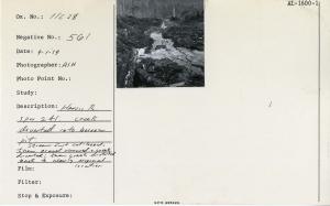
| Description: | Harris River, Spur 241: creek diverted into borrow pit. Stream first cat-logged, then gravel removed and creek diverted; then creek diverted back to nearly original location. |
| Date: | 9/1/1959 |
| Collection: | Pacific Northwest Research Station, Alaska Image Archive |
| Keywords: |
hydrology water conservation, soil conservation and erosion watershed management studies of infiltration, run-off and water erosion:effects of forestry practices (polluted water) |
| Location: | Alaska; Prince of Wales Island; Harris River |
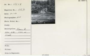
| Description: | Harris River, Spur 241: view up creek. |
| Date: | 9/1/1959 |
| Collection: | Pacific Northwest Research Station, Alaska Image Archive |
| Keywords: |
hydrology water conservation, soil conservation and erosion watershed management studies of infiltration, run-off and water erosion:effects of forestry practices (polluted water) |
| Location: | Alaska; Prince of Wales Island; Harris River |
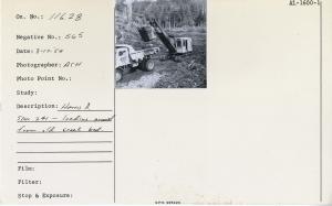
| Description: | Harris River, Spur 241 - loading gravel from old creek bed. |
| Date: | 8/17/1959 |
| Collection: | Pacific Northwest Research Station, Alaska Image Archive |
| Keywords: |
hydrology water conservation, soil conservation and erosion watershed management studies of infiltration, run-off and water erosion:effects of forestry practices (polluted water) |
| Location: | Alaska; Prince of Wales Island; Harris River |
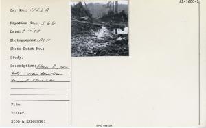
| Description: | Harris River, Spur 241: view downstream toward Spur 241. |
| Date: | 8/17/1959 |
| Collection: | Pacific Northwest Research Station, Alaska Image Archive |
| Keywords: |
hydrology water conservation, soil conservation and erosion watershed management studies of infiltration, run-off and water erosion:effects of forestry practices (polluted water) |
| Location: | Alaska; Prince of Wales Island; Harris River |
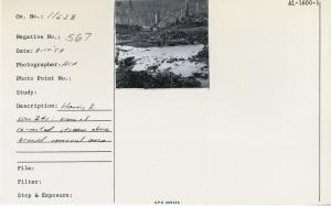
| Description: | Harris River, Spur 241: view of re-routed stream above gravel removal area. |
| Date: | 8/17/1959 |
| Collection: | Pacific Northwest Research Station, Alaska Image Archive |
| Keywords: |
hydrology water conservation, soil conservation and erosion watershed management studies of infiltration, run-off and water erosion:effects of forestry practices (polluted water) |
| Location: | Alaska; Prince of Wales Island; Harris River |
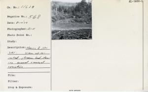
| Description: | Harris River, Spur 241: view up re-routed stream bed showing gravel removal operation. |
| Date: | 8/17/1959 |
| Collection: | Pacific Northwest Research Station, Alaska Image Archive |
| Keywords: |
hydrology water conservation, soil conservation and erosion watershed management studies of infiltration, run-off and water erosion:effects of forestry practices (polluted water) |
| Location: | Alaska; Prince of Wales Island; Harris River |
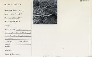
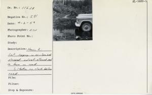
| Description: | Cat logging in creek, Spur 241. Plugged culvert allowed pool to form on road. Siltation on slash below road. |
| Date: | 7/2/1959 |
| Collection: | Pacific Northwest Research Station, Alaska Image Archive |
| Keywords: |
hydrology water conservation, soil conservation and erosion watershed management studies of infiltration, run-off and water erosion:effects of forestry practices (polluted water) |
| Location: | Alaska; Prince of Wales Island; Harris River |
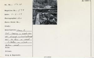
| Description: | Harris River: cat logging in creek, Spur 241. Plugged culvert allowed pool to form on road. Siltation on slash below road. |
| Date: | 7/2/1959 |
| Collection: | Pacific Northwest Research Station, Alaska Image Archive |
| Keywords: |
hydrology water conservation, soil conservation and erosion watershed management studies of infiltration, run-off and water erosion:effects of forestry practices (polluted water) |
| Location: | Alaska; Prince of Wales Island; Maybeso Valley |
| Description: | Freshet at 1/2 mile from KPC camp on road 100. Water entering culvert. |
| Date: | 7/2/1959 |
| Collection: | Pacific Northwest Research Station, Alaska Image Archive |
| Keywords: |
hydrology water conservation, soil conservation and erosion watershed management studies of infiltration, run-off and water erosion:effects of forestry practices (polluted water) |
| Location: | Alaska; Prince of Wales Island; Twelvemile Arm |
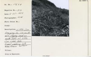
| Description: | Little Jim Logging Company, 12-mile Arm. Logging road on north side of Little Jim Creek. Note gravel washing into stream bottom. |
| Date: | 6/25/1958 |
| Collection: | Pacific Northwest Research Station, Alaska Image Archive |
| Keywords: |
hydrology water conservation, soil conservation and erosion watershed management studies of infiltration, run-off and water erosion:effects of forestry practices (polluted water) |
| Location: | Alaska; Prince of Wales Island; Twelvemile Arm |
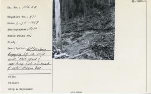
| Description: | Little Jim Logging Company, 12-mile Arm. Note gravel washing out of road & into stream bed. |
| Date: | 6/25/1958 |
| Collection: | Pacific Northwest Research Station, Alaska Image Archive |
| Keywords: |
hydrology water conservation, soil conservation and erosion watershed management studies of infiltration, run-off and water erosion:effects of forestry practices (polluted water) |
| Location: | Alaska; Helm Bay; Helm Creek |
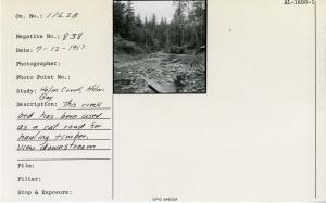
| Description: | This creek bed has been used as a cat road for hauling timber. View downstream. |
| Date: | 7/12/1957 |
| Collection: | Pacific Northwest Research Station, Alaska Image Archive |
| Keywords: |
hydrology water conservation, soil conservation and erosion watershed management studies of infiltration, run-off and water erosion:effects of forestry practices (polluted water) |
| Location: | Alaska; Helm Bay; Helm Creek |
| Description: | Looking upstream from location of previous photo. Note fine stand of alder that followed logging. |
| Date: | 7/12/1957 |
| Collection: | Pacific Northwest Research Station, Alaska Image Archive |
| Keywords: |
hydrology water conservation, soil conservation and erosion watershed management studies of infiltration, run-off and water erosion:effects of forestry practices (polluted water) |
| Location: | Alaska; Revillagigedo Island; Traitors Cove |
| Description: | Note active sluffing of dissected slope at right-center occurring as a result of soft shale bedrock overlain by granite cliffs (discernable at top of photo). |
| Date: | 7/11/1957 |
| Collection: | Pacific Northwest Research Station, Alaska Image Archive |
| Keywords: |
hydrology water conservation, soil conservation and erosion watershed management studies of infiltration, run-off and water erosion:effects of forestry practices (polluted water) |
| Location: | Alaska; Revillagigedo Island; Traitors Cove |
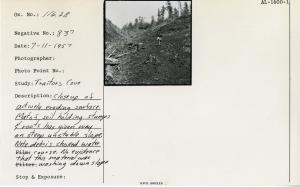
| Description: | Closeup of actively eroding surface. Mat of soil holding stumps & roots has given way on steep unstable slope. Note debris choked water course. No evidence that this material was washing down slope. |
| Date: | 7/11/1957 |
| Collection: | Pacific Northwest Research Station, Alaska Image Archive |
| Keywords: |
hydrology water conservation, soil conservation and erosion watershed management studies of infiltration, run-off and water erosion:effects of forestry practices (polluted water) |
| Location: | Alaska; Prince of Wales Island; Maybeso Valley; Halfmile Creek |
| Description: | Creek cutting under bridge on road #200. |
| Date: | 10/25/1956 |
| Collection: | Pacific Northwest Research Station, Alaska Image Archive |
| Keywords: |
hydrology water conservation, soil conservation and erosion watershed management studies of infiltration, run-off and water erosion:effects of forestry practices (polluted water) |
| Location: | Alaska; Prince of Wales Island |
| Description: | Skid trail becoming a water course. Area logged 1953 below junction of main roads #100 & #200. |
| Date: | 10/1956 |
| Collection: | Pacific Northwest Research Station, Alaska Image Archive |
| Keywords: |
hydrology water conservation, soil conservation and erosion watershed management studies of infiltration, run-off and water erosion:effects of forestry practices (polluted water) |
| Location: | Alaska; Prince of Wales Island; Maybeso Valley; Halfmile Creek |
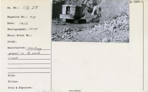
| Description: | Washing gravel in 1/2 mile creek. |
| Date: | 1956 |
| Collection: | Pacific Northwest Research Station, Alaska Image Archive |
| Keywords: |
hydrology water conservation, soil conservation and erosion watershed management studies of infiltration, run-off and water erosion:effects of forestry practices (polluted water) |
| Location: | Alaska; Prince of Wales Island; Maybeso Valley |
| Description: | Maybeso about 4 mile. Note damming by recent debris added by log jam. [Date estimated.] |
| Date: | 1956 |
| Collection: | Pacific Northwest Research Station, Alaska Image Archive |
| Keywords: |
hydrology water conservation, soil conservation and erosion watershed management studies of infiltration, run-off and water erosion:effects of forestry practices (polluted water) |
| Location: | Alaska; McCarty Cove |
| Description: | Note road & mud & silt that will wash out in fall floods. Can't hurt this non-fish stream, but good example of potential erosion. For forestry, erosion probably beneficial if it promotes drainage. |
| Date: | 8/17/1950 |
| Collection: | Pacific Northwest Research Station, Alaska Image Archive |
| Keywords: |
hydrology water conservation, soil conservation and erosion watershed management studies of infiltration, run-off and water erosion:effects of forestry practices (polluted water) |
| Location: | Alaska; McCarty Cove |
| Description: | Lots of clay in this bank-potential silt for stream. Note muddy road. Will flush out this fall. |
| Date: | 8/17/1950 |
| Collection: | Pacific Northwest Research Station, Alaska Image Archive |
| Keywords: |
hydrology water conservation, soil conservation and erosion watershed management studies of infiltration, run-off and water erosion:effects of forestry practices (polluted water) |
| Location: | Alaska; McCarty Cove |
| Description: | Creek diverted out of road on approach above falls below body of sale area. Flow turned out at center-left. Original choked up channel between diversion channel & road. High water will probably flow down road too. Before diversion, every rain caused serious removal of small materials from road. |
| Date: | 8/17/1950 |
| Collection: | Pacific Northwest Research Station, Alaska Image Archive |
| Keywords: |
hydrology water conservation, soil conservation and erosion watershed management studies of infiltration, run-off and water erosion:effects of forestry practices (polluted water) |
| Location: | Alaska; McCarty Cove |
| Description: | Cold deck at cat landing from swing to beach. Erosion begins here. In timber sale area proper. |
| Date: | 8/17/1950 |
| Collection: | Pacific Northwest Research Station, Alaska Image Archive |
| Keywords: |
hydrology water conservation, soil conservation and erosion watershed management studies of infiltration, run-off and water erosion:effects of forestry practices (polluted water) |
| Location: | Alaska; Prince of Wales Island; Calder Bay |
| Description: | Cat crossing just below spar pole. This jam may be 50-50 nature & logging. Most of this stream is much coarser gravel than this. |
| Date: | 8/9/1950 |
| Collection: | Pacific Northwest Research Station, Alaska Image Archive |
| Keywords: |
hydrology water conservation, soil conservation and erosion watershed management studies of infiltration, run-off and water erosion:effects of forestry practices (polluted water) |
| Location: | Alaska; Southeast |
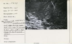
| Description: | Three Islands sale - Purdy Logging Co. Location of the rock ledge forming upper falls now clear & passable to fish when water is high enough for fish to ascend stream. |
| Date: | 3/13/1950 |
| Collection: | Pacific Northwest Research Station, Alaska Image Archive |
| Keywords: |
hydrology water conservation, soil conservation and erosion watershed management studies of infiltration, run-off and water erosion:effects of forestry practices (polluted water) |
| Location: | Alaska; Southeast |
| Description: | Three Islands sale - Purdy Logging Co. Looking downstream from point where cat road leaves the creek. Was location of permanent, impassable log jam. Dam removed during logging thus allowing passage of fish during high water. |
| Date: | 3/13/1950 |
| Collection: | Pacific Northwest Research Station, Alaska Image Archive |
| Keywords: |
hydrology water conservation, soil conservation and erosion watershed management studies of infiltration, run-off and water erosion:effects of forestry practices (polluted water) |
| Location: | Alaska; Southeast |
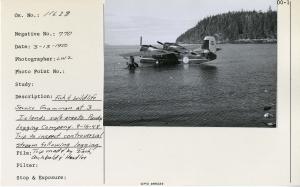
| Description: | Fish & Wildlife Service Grumman at 3 Islands sale area to Purdy Logging Company. 9-16-48 trip to inspect controversial stream following logging. Trip made by Zach, Archbold & Hadlee. |
| Date: | 3/13/1950 |
| Collection: | Pacific Northwest Research Station, Alaska Image Archive |
| Keywords: |
hydrology water conservation, soil conservation and erosion watershed management studies of infiltration, run-off and water erosion:effects of forestry practices (polluted water) |
| Location: | Alaska; Southeast |
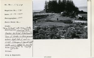
| Description: | Three Islands sale area - Purdy Logging Co. Looking into harbor behind breakwater. Tops & limbs in foreground above high tide & not in creek. Stumps & logs at right center were added to Smith's breakwater by logging operator. |
| Date: | 3/13/1950 |










![Maybeso about 4 mile. Note damming by recent debris added by log jam. [Date estimated.] Maybeso about 4 mile. Note damming by recent debris added by log jam. [Date estimated.]](/rds/imagedb/images/_thm/31351.jpg)


