| Collection: | RMRS Archive Images |
| Keywords: |
erosion watershed management |
| Location: | San Simon ; AZ; United States |
| Description: | Erosion Rehabilitation at San Simon, Arizona |
| Date: |
| Collection: | RMRS Archive Images |
| Keywords: |
erosion watershed management |
| Location: | San Simon ; AZ; United States |
| Description: | Erosion Rehabilitation at San Simon, Arizona |
| Date: |
| Collection: | RMRS Archive Images |
| Keywords: |
erosion watershed management |
| Location: | San Simon ; AZ; United States |
| Description: | Erosion Rehabilitation at San Simon, Arizona |
| Date: |
| Collection: | RMRS Archive Images |
| Keywords: |
erosion watershed management |
| Location: | AZ; United States |
| Description: | Erosion Rehabilitation at San Simon, Arizona |
| Date: |
| Collection: | RMRS Archive Images |
| Keywords: |
desert shrub erosion watershed management |
| Location: | AZ; United States |
| Description: | Cienega, erosion |
| Date: |
| Collection: | RMRS Archive Images |
| Keywords: |
erosion watershed management |
| Organisms: | pinyon-juniper |
| Location: | White Mountains; AZ; United States |
| Description: | gully erosion, Limestone Canyon Fort Apache Reservation |
| Date: |
| Collection: | RMRS Archive Images |
| Keywords: |
wildfire erosion watershed research |
| Location: | Boise National Forest; ID; United States |
| Description: | Research Engineer Pete Robichaud measure the depth to which a fire consumed the organic layer of forest soil. |
| Date: |
| Collection: | RMRS Archive Images |
| Keywords: |
wildfire erosion watershed research |
| Location: | Boise National Forest; ID; United States |
| Description: | Dr. Pete Robichaud collects soil samples before a prescribed fire to collect data for forest applications of the Water Erosion Prediction Process (WEPP) model. |
| Date: |
| Collection: | Fort Valley Experimental Forest historical photographs |
| Keywords: |
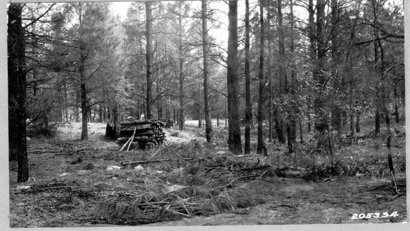
thinning erosion brush |
| Organisms: | pine |
| Location: | Prescott National Forest; AZ; United States |
| Description: | Brush placed in gully to stop erosion |
| Date: |
| Collection: | Fort Valley Experimental Forest historical photographs |
| Keywords: | erosion |
| Location: | |
| Description: | Not Available |
| Date: |
| Collection: | Sierra Ancha Historical Images |
| Keywords: | erosion |
| Location: | Cuba; NM; USA |
| Description: | Breakdown of steep hill |
| Date: |
| Collection: | Sierra Ancha Historical Images |
| Keywords: | erosion |
| Location: | Tonto N. F.; Az; USA |
| Description: | Erosion control |
| Date: |
| Collection: | Sierra Ancha Historical Images |
| Keywords: |
soil erosion drainage |
| Location: | Prescott NF; AZ; USA |
| Description: | Watershed Project |
| Date: |
| Collection: | Sierra Ancha Historical Images |
| Keywords: |
erosion brush |
| Location: | Sierra Ancha NF; AZ; USA |
| Description: | Range Study |
| Date: |


