| Collection: | Southern Research Station Historical Documents and Images |
| Keywords: |
weir stream gage |
| Location: | West Nesbitt Creek, Irons Fork Experimental Forest, Arkansas |
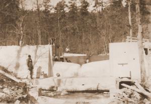
| Description: | Caption reads: "A modified Columbus deep-notch weir and approach basis under construction on West Nesbitt Creek." |
| Date: | Mar-42 |
| Collection: | Southern Research Station Historical Documents and Images |
| Keywords: |
weir stream gage |
| Location: | West Nesbitt Creek, Irons Fork Experimental Forest, Arkansas |
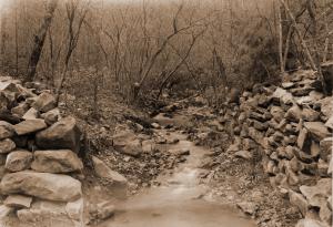
| Description: | Caption reads: "Figure 4. Channel above Gaging Point No. 1, West Nesbitt Creek. Watershed area 156.0 acres." From "Report on the Hoover-Nesbitt Creek Watersheds, Irons Fork Experimental Forest" by Norman E. Hawes, unpublished 10 page report written on April 9, 1940. |
| Date: | Apr-40 |
| Collection: | Southern Research Station Historical Documents and Images |
| Keywords: |
weir stream gage |
| Location: | West Nesbitt Creek, Irons Fork Experimental Forest, Arkansas |
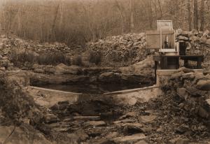
| Description: | Caption reads: "Figure 3. Gaging Point No. 1, West Nesbitt Creek. Watershed area 156.0 acres." From "Report on the Hoover-Nesbitt Creek Watersheds, Irons Fork Experimental Forest" by Norman E. Hawes, unpublished 10 page report written on April 9, 1940. |
| Date: | Mar-40 |


