| Collection: | Pacific Northwest Research Station, Alaska Image Archive |
| Keywords: |
plant ecology ecosystems vegetation types ecotypes |
| Location: | Alaska; Prince of Wales Island; Maybeso Valley |
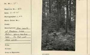
| Description: | Near mouth of Maybeso Creek. Mature spruce-hemlock type. On flat just above gauge. |
| Date: | 8/15/1961 |
| Collection: | Pacific Northwest Research Station, Alaska Image Archive |
| Keywords: |
hydrology water conservation, soil conservation and erosion watershed management studies on stream-flow and bank erosion: effects of forestry practices (polluted water) |
| Location: | Alaska; Chichagof Island; Fick Cove |
| Description: | Upper tidal zone. Gravel samples taken in creek opposite pack sack. Heavy spawning through this section. |
| Date: | 10/17/1951 |
| Collection: | Pacific Northwest Research Station, Alaska Image Archive |
| Keywords: |
hydrology water conservation, soil conservation and erosion watershed management studies on stream-flow and bank erosion: effects of forestry practices (polluted water) |
| Location: | Alaska; Chichagof Island; Fick Cove |
| Description: | Tractor crossing of creek-fork in upper tidal zone. Some channel filling from cutting in approaches. Effects localized. Heavy spawning this season all through here. Example of acceptable crossing. |
| Date: | 10/17/1951 |
| Collection: | Pacific Northwest Research Station, Alaska Image Archive |
| Keywords: |
hydrology water conservation, soil conservation and erosion watershed management studies on stream-flow and bank erosion: effects of forestry practices (polluted water) |
| Location: | Alaska; Chichagof Island; Fick Cove |
| Description: | 200 yards above tidal zone. Logged to creek winter 1950-51. Creek clear now, could have cut leaners to remove potential jams. |
| Date: | 10/17/1951 |
| Collection: | Pacific Northwest Research Station, Alaska Image Archive |
| Keywords: |
hydrology water conservation, soil conservation and erosion watershed management studies on stream-flow and bank erosion: effects of forestry practices (polluted water) |
| Location: | Alaska; Chichagof Island; Fick Cove |
| Description: | CP2 across gravel bar from 8" alder marked "CP2". 650' above CP1. Merchantable logged to creek on left. Could have taken marginal leaners & thus removed potential windfalls. |
| Date: | 10/17/1951 |
| Collection: | Pacific Northwest Research Station, Alaska Image Archive |
| Keywords: |
hydrology water conservation, soil conservation and erosion watershed management studies on stream-flow and bank erosion: effects of forestry practices (polluted water) |
| Location: | Alaska; Chichagof Island; Fick Cove |
| Description: | Looking toward west side of creek. Cutover & logged winter '50-'51. Tractor yarding. No change in creek. Little potential danger where logged clean to creek. Stump uncut was potential windfall. Good practice. |
| Date: | 10/17/1951 |
| Collection: | Pacific Northwest Research Station, Alaska Image Archive |
| Keywords: |
hydrology water conservation, soil conservation and erosion watershed management studies on stream-flow and bank erosion: effects of forestry practices (polluted water) |
| Location: | Alaska; Chichagof Island; Fick Cove |
| Description: | Tractor crossing on Ficke Cove Creek used winter 1950-51. Example of acceptable crossing. Fish spawned all through this section, creek & bed unaffected. |
| Date: | 10/17/1951 |
| Collection: | Pacific Northwest Research Station, Alaska Image Archive |
| Keywords: |
hydrology water conservation, soil conservation and erosion watershed management studies on stream-flow and bank erosion: |
| Location: | Alaska; Chichagof Island; Fick Cove |
| Description: | Gravel samples taken on cross section at center of photo. 500' above confluence of tributary stream near head of tidal zone. |
| Date: | 10/16/1951 |
| Collection: | Pacific Northwest Research Station, Alaska Image Archive |
| Keywords: |
hydrology water conservation, soil conservation and erosion watershed management studies on stream-flow and bank erosion: |
| Location: | Alaska; Chichagof Island; Fick Cove |
| Description: | Spruce on creek bank was undermined before logging, fell across creek, gravel filled up to level of down trunk. Sure indication of substantial floods & fluctuations. |
| Date: | 10/16/1951 |
| Collection: | Pacific Northwest Research Station, Alaska Image Archive |
| Keywords: |
hydrology water conservation, soil conservation and erosion watershed management studies on stream-flow and bank erosion: |
| Location: | Alaska; Chichagof Island; Fick Cove |
| Description: | Natural jam 200 yards above CP3. 60 cohos, 10 dogs in hole behind it. No obstruction at all. |
| Date: | 10/16/1951 |
| Collection: | Pacific Northwest Research Station, Alaska Image Archive |
| Keywords: |
hydrology water conservation, soil conservation and erosion watershed management studies on stream-flow and bank erosion: |
| Location: | Alaska; Chichagof Island; Fick Cove |
| Description: | Log span bridge over creek, 1 mile from beach. Practical structure. |
| Date: | 10/16/1951 |
| Collection: | Pacific Northwest Research Station, Alaska Image Archive |
| Keywords: |
hydrology water conservation, soil conservation and erosion watershed management studies on stream-flow and bank erosion: effects of forestry practices (polluted water) |
| Location: | Alaska; Chichagof Island; Fick Cove |
| Description: | Looking west into logged area. Good logging, little material to foul up creek. Note low elevation of cutover. Can flood during high water & does not scour stream bed badly. |
| Date: | 10/16/1951 |
| Collection: | Pacific Northwest Research Station, Alaska Image Archive |
| Keywords: |
hydrology water conservation, soil conservation and erosion watershed management studies on stream-flow and bank erosion: effects of forestry practices (polluted water) |
| Location: | Alaska; Chichagof Island; Fick Cove |
| Description: | 4" alder on bar referenced to 8" hemlock to east marked "CP3." Natural streambed, looking across bar into cut over. No change to creek. Floods cut over during high water. |
| Date: | 10/16/1951 |
| Collection: | Pacific Northwest Research Station, Alaska Image Archive |
| Keywords: |
hydrology water conservation, soil conservation and erosion watershed management studies on stream-flow and bank erosion: effects of forestry practices (polluted water) |
| Location: | Alaska; Chichagof Island; Fick Cove |
| Description: | Gravel samples about center of photo. See reference blaze on spruce at upper center of photo. Sampling cans at lower left. |
| Date: | 10/16/1951 |
| Collection: | Pacific Northwest Research Station, Alaska Image Archive |
| Keywords: |
hydrology water conservation, soil conservation and erosion watershed management studies on stream-flow and bank erosion: |
| Location: | Alaska; Prince of Wales Island; McKenzie Inlet |
| Description: | Upper tidal zone of McKenzie Inlet stream. Only fair spawning facilities in this creek. Tidal zone is the important spawning area here. |
| Date: | 9/29/1951 |
| Collection: | Pacific Northwest Research Station, Alaska Image Archive |
| Keywords: |
hydrology water conservation, soil conservation and erosion watershed management studies on stream-flow and bank erosion: |
| Location: | Alaska; Prince of Wales Island; McKenzie Inlet |
| Description: | Falls on unlogged McKenzie Inlet stream 1/4 mile above tidal zone. Fish cannot go beyond here. Gravel not suitable here, water too fast. |
| Date: | 9/29/1951 |
| Collection: | Pacific Northwest Research Station, Alaska Image Archive |
| Keywords: |
hydrology water conservation, soil conservation and erosion watershed management studies on stream-flow and bank erosion:\ 157 fish management: fishing |
| Location: | Alaska; Prince of Wales Island; Old Tom Creek |
| Description: | Upper tidal zone, crowded with fish, water too low. |
| Date: | 9/28/1951 |
| Collection: | Pacific Northwest Research Station, Alaska Image Archive |
| Keywords: |
hydrology water conservation, soil conservation and erosion watershed management studies on stream-flow and bank erosion:\ 157 fish management: fishing |
| Location: | Alaska; Prince of Wales Island; Old Tom Creek |
| Description: | Water too low, gage 1.6'. Spawners packed into stream. Mortality high. In photo are stranded, dead fish from receding tide. |
| Date: | 9/28/1951 |
| Collection: | Pacific Northwest Research Station, Alaska Image Archive |
| Keywords: |
animal ecology game and fish management hunting, shooting and fishing fish management: fishing |
| Location: | Alaska; Prince of Wales Island; Old Tom Creek |
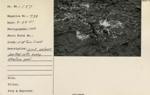
| Description: | Pink salmon packed into every shallow pool. |
| Date: | 9/28/1951 |
| Collection: | Pacific Northwest Research Station, Alaska Image Archive |
| Keywords: |
animal ecology game and fish management hunting, shooting and fishing fish management: fishing |
| Location: | Alaska; Prince of Wales Island; Old Tom Creek |
| Description: | Over crowded with spawners. |
| Date: | 9/28/1951 |
| Collection: | Pacific Northwest Research Station, Alaska Image Archive |
| Keywords: |
plant ecology ecosystems vegetation types ecotypes |
| Location: | Alaska; Prince of Wales Island; Maybeso Valley |
| Description: | Plot No. 1, near mouth of Maybeso Creek. Mature spruce & hemlock type. Good site. |
| Date: | 8/15/1951 |
| Collection: | Pacific Northwest Research Station, Alaska Image Archive |
| Keywords: |
hydrology water conservation, soil conservation and erosion watershed management studies on stream-flow and bank erosion: |
| Location: | Alaska; Prince of Wales Island; Indian Creek |
| Description: | RP1 at head of tidal zone. This type of locational marker used on study streams to tie data in place. Cruiser's axe for comparison. |
| Date: | 10/2/1950 |
| Collection: | Pacific Northwest Research Station, Alaska Image Archive |
| Keywords: |
hydrology water conservation, soil conservation and erosion watershed management studies on stream-flow and bank erosion: |
| Location: | Alaska; Prince of Wales Island; Indian Creek |
| Description: | RP2, location & reference marker used along study steams. Looks like "RP3" to me - DMB [Daniel M. Bishop]. |
| Date: | 10/2/1950 |
| Collection: | Pacific Northwest Research Station, Alaska Image Archive |
| Keywords: |
hydrology water conservation, soil conservation and erosion watershed management studies on stream-flow and bank erosion: miscellaneous |
| Location: | Alaska; Prince of Wales Island; Indian Creek |
| Description: | Oil tube for winter operation of stream gage. 12" diameter by 20' long of 20 gage galvanized iron. About 75 lbs. packed in. Tube placed in gage house well. Given charge of 5-10 gallons of kerosene. Float rests on kerosene which forms a non-freezing column through ice to unfrozen water below. |
| Date: | 10/2/1950 |
| Collection: | Pacific Northwest Research Station, Alaska Image Archive |
| Keywords: |
hydrology water conservation, soil conservation and erosion watershed management studies on stream-flow and bank erosion: |
| Location: | Alaska; Prince of Wales Island; Maybeso Valley |
| Description: | Maybeso Creek. |
| Date: | 10/1950 |
| Collection: | Pacific Northwest Research Station, Alaska Image Archive |
| Keywords: |
silvicultural systems constitution and composition of stands forms of stand high forest systems clear felling |
| Location: | Alaska; Chickamin River |
| Description: | Cutover spruce flat on Chaickamin River logged about 1943. Complete cover of brush, grass, reprod spotty. Largest clearcut in Alaska to date (1950) see No. 432. |
| Date: | 9/27/1950 |
| Collection: | Pacific Northwest Research Station, Alaska Image Archive |
| Keywords: |
silvicultural systems constitution and composition of stands forms of stand high forest systems clear felling |
| Location: | Alaska; Chickamin River |
| Description: | Cutover spruce flat on Chaickamin River logged about 1943. Complete cover of brush, grass, reprod spotty. Largest clearcut in Alaska to date (1950) see No. 433. |
| Date: | 9/27/1950 |
| Collection: | Pacific Northwest Research Station, Alaska Image Archive |
| Keywords: |
hydrology water conservation, soil conservation and erosion watershed management studies on stream-flow and bank erosion: |
| Location: | Alaska; McCarty Cove |
| Description: | Summary Report, Figure 6 in Zach, Effects of Logging in Salmon Streams. |
| Date: | 9/26/1950 |
| Collection: | Pacific Northwest Research Station, Alaska Image Archive |
| Keywords: |
hydrology water conservation, soil conservation and erosion watershed management studies on stream-flow and bank erosion: |
| Location: | Alaska; Prince of Wales Island; Maybeso Valley |
| Description: | Looking upstream from foot log to top of gorge. Gage = 4', discharge = 782 sec.-ft. Minimum discharge = 10 sec. ft. Maximum discharge = 3460 sec. ft. |
| Date: | 9/22/1950 |
| Collection: | Pacific Northwest Research Station, Alaska Image Archive |
| Keywords: |
hydrology water conservation, soil conservation and erosion watershed management studies on stream-flow and bank erosion: miscellaneous |
| Location: | Alaska; Prince of Wales Island; Harris River |
| Description: | Gage house, gage at 2.86'. From C.P. above Dawson Landing. Discharge at this stage 505 sec.-ft. Minimum measured discharge = 17 sec.-ft. Maximum known discharge = 7360 sec.-ft. Maximum flood height in 1949 was over the top of the well. |
| Date: | 9/20/1950 |
| Collection: | Pacific Northwest Research Station, Alaska Image Archive |
| Keywords: |
hydrology water conservation, soil conservation and erosion watershed management studies on stream-flow and bank erosion: |
| Location: | Alaska; Prince of Wales Island; Maybeso Valley |
| Description: | C.P. on discharge foot log. Gage = 2.10 ft. Note fast flow & large boulders. Fish do not attempt to spawn in this section. Discharge = 229 sec. ft. Minimum discharge = 13 sec. ft. Maximum measured discharge = 3460 sec. ft. |
| Date: | 9/19/1950 |
| Collection: | Pacific Northwest Research Station, Alaska Image Archive |
| Keywords: |
animal ecology game and fish management hunting, shooting and fishing fish management: fishing |
| Location: | Alaska; Prince of Wales Island; Twelvemile Arm |
| Description: | Male & female pink salmon. Fresh run & not yet spawned out. 18" ruler along side typical specimens. |
| Date: | 9/16/1950 |
| Collection: | Pacific Northwest Research Station, Alaska Image Archive |
| Keywords: |
hydrology water conservation, soil conservation and erosion watershed management studies on stream-flow and bank erosion: |
| Location: | Alaska; Prince of Wales Island; Indian Creek |
| Description: | From C.P. up stream on Indian Creek. Low water - gage at .65'. Gage house at right. |
| Date: | 9/15/1950 |
| Collection: | Pacific Northwest Research Station, Alaska Image Archive |
| Keywords: |
hydrology water conservation, soil conservation and erosion watershed management studies on stream-flow and bank erosion: |
| Location: | Alaska; Prince of Wales Island; Indian Creek |
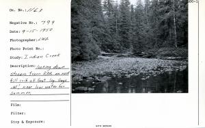
| Description: | Looking down stream from R.P.A. on rock fill crib of foot log. Gage .65', near low water for summer. |
| Date: | 9/15/1950 |
| Collection: | Pacific Northwest Research Station, Alaska Image Archive |
| Keywords: |
hydrology water conservation, soil conservation and erosion watershed management studies on stream-flow and bank erosion: |
| Location: | Alaska; Prince of Wales Island; Indian Creek |
| Description: | From C.P. below gage house looking down stream. Gage .65'. Logs packed in by high water. |
| Date: | 9/15/1950 |
| Collection: | Pacific Northwest Research Station, Alaska Image Archive |
| Keywords: |
hydrology water conservation, soil conservation and erosion watershed management studies on stream-flow and bank erosion: |
| Location: | Alaska; Prince of Wales Island; Maybeso Valley |
| Description: | Above R.P. 6 where stream enters Maybeso from south. Note flat valley type, mature, merchantable spruce. Noted scoured gravel & piled up debris from natural floods. |
| Date: | 9/1950 |
| Collection: | Pacific Northwest Research Station, Alaska Image Archive |
| Keywords: |
hydrology water conservation, soil conservation and erosion watershed management studies on stream-flow and bank erosion: |
| Location: | Alaska; Prince of Wales Island; Harris River |
| Description: | From C.P. at gage house. Low water, gage 1.05', discharge 54 sec.-ft. |
| Date: | 9/1950 |
| Collection: | Pacific Northwest Research Station, Alaska Image Archive |
| Keywords: |
hydrology water conservation, soil conservation and erosion watershed management studies on stream-flow and bank erosion: |
| Location: | Alaska; Prince of Wales Island; Maybeso Valley |
| Description: | Gage 1.02' just above RP5. Fresh windfall over older stuff. All natural. Typical of timbered flat where natural bank cutting creates these conditions. Note scoured bar & sand deposit from high water eddy. |
| Date: | 9/1950 |
| Collection: | Pacific Northwest Research Station, Alaska Image Archive |
| Keywords: |
animal ecology game and fish management hunting, shooting and fishing fish management: fishing |
| Location: | Alaska; Prince of Wales Island; Maybeso Valley |
| Description: | Fresh run female dog (chum) salmon. 12" scale at side. Note "pan" marks on dog salmon. Few dog salmon got over Maybeso Creek Falls in 1950. |
| Date: | 9/1950 |
| Collection: | Pacific Northwest Research Station, Alaska Image Archive |
| Keywords: |
hydrology water conservation, soil conservation and erosion watershed management studies of infiltration, run-off and water erosion:effects of forestry practices (polluted water) |
| Location: | Alaska; McCarty Cove |
| Description: | Note road & mud & silt that will wash out in fall floods. Can't hurt this non-fish stream, but good example of potential erosion. For forestry, erosion probably beneficial if it promotes drainage. |
| Date: | 8/17/1950 |
| Collection: | Pacific Northwest Research Station, Alaska Image Archive |
| Keywords: |
hydrology water conservation, soil conservation and erosion watershed management studies of infiltration, run-off and water erosion:effects of forestry practices (polluted water) |
| Location: | Alaska; McCarty Cove |
| Description: | Lots of clay in this bank-potential silt for stream. Note muddy road. Will flush out this fall. |
| Date: | 8/17/1950 |
| Collection: | Pacific Northwest Research Station, Alaska Image Archive |
| Keywords: |
hydrology water conservation, soil conservation and erosion watershed management studies of infiltration, run-off and water erosion:effects of forestry practices (polluted water) |
| Location: | Alaska; McCarty Cove |
| Description: | Creek diverted out of road on approach above falls below body of sale area. Flow turned out at center-left. Original choked up channel between diversion channel & road. High water will probably flow down road too. Before diversion, every rain caused serious removal of small materials from road. |
| Date: | 8/17/1950 |
| Collection: | Pacific Northwest Research Station, Alaska Image Archive |
| Keywords: |
hydrology water conservation, soil conservation and erosion watershed management studies of infiltration, run-off and water erosion:effects of forestry practices (polluted water) |
| Location: | Alaska; McCarty Cove |
| Description: | Cold deck at cat landing from swing to beach. Erosion begins here. In timber sale area proper. |
| Date: | 8/17/1950 |
| Collection: | Pacific Northwest Research Station, Alaska Image Archive |
| Keywords: |
animal ecology game and fish management hunting, shooting and fishing fish management: fishing |
| Location: | Alaska; Peril Strait; False Island |
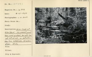
| Description: | Minor creek at False Island. Fry present, small flow, small gradient, too soft for cat. Silt and rock, no obstruction. Negative from Kodachrome, 30-salmon stream study. |
| Date: | 8/15/1950 |
| Collection: | Pacific Northwest Research Station, Alaska Image Archive |
| Keywords: |
animal ecology game and fish management hunting, shooting and fishing fish management: fishing |
| Location: | Alaska; Kupreanof Island; Tunehean Creek |
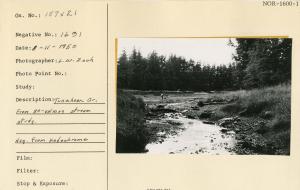
| Description: | Tunehean Creek. From 30-salmon stream study. |
| Date: | 8/11/1950 |
| Collection: | Pacific Northwest Research Station, Alaska Image Archive |
| Keywords: |
animal ecology game and fish management hunting, shooting and fishing fish management: fishing |
| Location: | Alaska; Kupreanof Island; Tunehean Creek |
| Description: | Tunehean Creek. From study of 30 salmon streams. |
| Date: | 8/11/1950 |
| Collection: | Pacific Northwest Research Station, Alaska Image Archive |
| Keywords: |
hydrology water conservation, soil conservation and erosion watershed management studies of infiltration, run-off and water erosion:effects of forestry practices (polluted water) |
| Location: | Alaska; Prince of Wales Island; Calder Bay |
| Description: | Cat crossing just below spar pole. This jam may be 50-50 nature & logging. Most of this stream is much coarser gravel than this. |
| Date: | 8/9/1950 |
| Collection: | Pacific Northwest Research Station, Alaska Image Archive |
| Keywords: |
hydrology water conservation, soil conservation and erosion watershed management studies on stream-flow and bank erosion: |
| Location: | Alaska; Prince of Wales Island; Steelhead Creek |
| Description: | Natural debris on the east fork. Short distance above cutting, about 1/4 mile from mouth. Before logging Ivan Jones reports only 1/4 mile of steam possible to fish. |
| Date: | 8/8/1950 |
| Collection: | Pacific Northwest Research Station, Alaska Image Archive |
| Keywords: |
hydrology water conservation, soil conservation and erosion watershed management studies on stream-flow and bank erosion: |
| Location: | Alaska; Prince of Wales Island; Dog Salmon Creek |
| Description: | 1/4 mile from mouth. Note logs & debris. Some logging some natural, heavy brush growth. Coho fry all along this stream, also bones from last year's spawners. |
| Date: | 8/7/1950 |
| Collection: | Pacific Northwest Research Station, Alaska Image Archive |
| Keywords: |
hydrology water conservation, soil conservation and erosion watershed management studies on stream-flow and bank erosion: |
| Location: | Alaska; Prince of Wales Island; Little Steelhead Creek |
| Description: | High water channel in lower portion of stream shows flood occurrence. |
| Date: | 8/7/1950 |





![RP2, location & reference marker used along study steams. Looks like "RP3" to me - DMB [Daniel M. Bishop]. RP2, location & reference marker used along study steams. Looks like "RP3" to me - DMB [Daniel M. Bishop].](/rds/imagedb/images/_thm/31437.jpg)


