
Official websites use .gov
A .gov
website belongs to an official government organization in the
United States.
Secure .gov websites use HTTPS
A lock
(
) or https:// means you've safely
connected to the .gov website. Share sensitive information only
on official, secure websites.


Kinderhook Trailhead
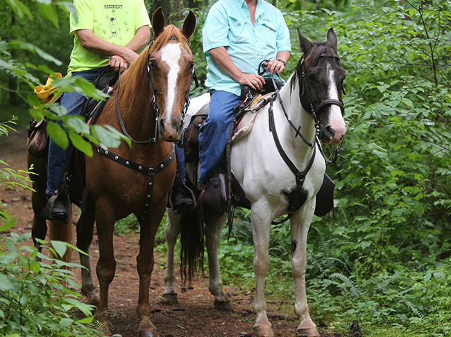
This is the Wayne National Forest's newest trail system which provides 12 miles of scenic riding. Horses, mountain bike riders, and hikers are welcome on this trail.The trail winds through some of the steeper hills on the Wayne National Forest. It will lead you through a variety of vegetation: open fields, brushland, mature forest, and new forest. Along the way, you may glimpse wildlife, and will recognize the influence of humans, both now and in the past. You will also pass many of our land management activities.
At a Glance
| Operational Hours: |
|
|---|---|
| Fees: | No fees required. |
| Closest Towns: | Newport, OH |
| Water: | None |
| Restroom: | Vault |
| Operated By: |
General Information
General Notes:This trailhead is part of the the Kinderhook Riding Trail. See a map of the area.
Directions:
To find this campground and trailhead west of Marietta, OH:
- Take Hwy. 7 east/north from Marietta to Newport (17 miles).
- Turn north at the Kinderhook sign at County Road 25, two miles past Newport
- Follow the road 0.8 miles to County Road 244 and the trailhead.
Parking:
Ample parking is available at trailhead.
Activities
Mountain Biking
Though this trail system is designed primarily for horseback riders, mountain bikers are welcome. 12 miles of trails are maintained but various loops for other distances are available.
| Permit required? | No |
|---|
Dispersed Camping
Primitive camping is allowed at no charge at the trailhead, but only during the horse and mountain bike riding open season.
| Fire Information |
|
|---|---|
| No. of Sites | Primitive camping is dispersed at trailhead. |
| Reservation Info | Sites are not able to be reserved. |
| No. of Accessible sites | 0 |
Day Hiking
Though this trail system is designed primarily for horseback riders, hikers are welcome. 12 miles of trails are maintained but various loops for other distances are available.
Backpacking
Though this trail system is designed primarily for horseback riders, hikers are welcome. 12 miles of trails are maintained but various loops for other distances are available.
| Fire Information |
|
|---|
Horse Camping
The trailhead is available for camping but is more a dispersed site with no designated sites or amenities.
| Corrals | No |
|---|---|
| Hitching Rails | Yes |
| Loading Ramp | No |
| Size Restrictions | No |
| Fire Information |
|
| No. of Sites | Not designated |
| Reservation Info | Sites are not able to be reserved. |
| No. of Accessible sites | None |
| Watering Tank | No |
Horse Riding
This 21-mile trail winds through the rolling hills of the Wayne National Forest.. It has been developed for horse use, but hiking is allowed.
| Corrals | No | |
|---|---|---|
| Hitching Rails | Yes | |
| Loading Ramp | No | |
| Size Restrictions | No | |
| Water Availability? |
|