

Visitor Maps and Guides
The Bighorn National Forest is located in north central Wyoming. We encourage you to explore our maps and informational handouts to help you plan your visit and to locate the Bighorn’s facilities, roads, trails, recreation sites, and other attractions.
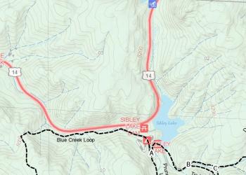
Forest Visitor Map

The visitor map provides information about services, campgrounds, picnic areas, and other attractions located in the Bighorn National Forest. It also includes information about travel restrictions, amenities at our facilities, and will help you locate some of the forest’s points of interest.
Motor Vehicle Use Map

The motor vehicle use map (MVUM) is the official place to find all designated roads and trails available for public motorized travel in the Bighorn National Forest. Visitors should not rely on any other maps for making decisions about motorized travel. Georeferenced motor vehicle use maps are available for Android and iOS devices.
Bighorn National Forest Informational Handouts

These downloadable handouts have information about attractions and activities in the Bighorn National Forest.
Free Downloadable Maps
Find downloadable maps to help with your trip planning and navigation. The Forest Service Topography maps overlay Forest Service assets such as roads, trails, and campgrounds, on USGS's topographic maps. They are available for download by quadrangle. The geospatial data available here includes ESRI format shapefiles, images, KML/KMZ format files, and GIS resource links.
USGS Topographic Maps

Topographic maps provide the greatest level of detail and cover small portions of a national forest or national grassland. These maps are available for purchase from the USGS Store.