
Visitor Maps and Guides
Need a map? There are a number of ways to help you get to where you're going.
Interactive Visitor Map

The fastest and easest way to explore the forest! Includes options to print your own map and create a georeferenced digital map.
Purchase Maps
Digital
A digitial version of the Carson National Forest map, split between areas at different price points, is available through Avenza Maps.
Physical
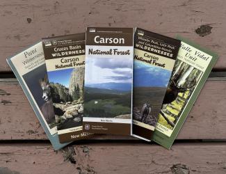
The following maps (pictured) are available for purchase in person or online for $14.00:
- Carson National Forest
- Cruces Basin Wilderness
- Pecos Wilderness
- Valle Vidal Unit
- Wheeler Peak, Latir Peak and Columbine-Hondo Wildernesses
Maps can be purchased in person at any of our offices, but please call ahead to make sure it's open and maps are in stock.
Purchase maps online for the Carson National Forest and other national forests and grasslands through our partners:
- USGS (Carson National Forest maps)
- Public Lands Interpretive Association
- Arizona Forest Maps
- New Mexico Forest Maps
- All National Forest Service Maps
Other Maps
Motor Vehicle Use Maps
Motor Vehicle Use Maps (MVUM) are the official maps for motorized travel on the Carson National Forest.
Fuelwood

Fuelwood maps are for visitors with a permit.
| Title | Type | Link |
|---|---|---|
| Rio Santa Barbara Trails | GeoPdf | Trails #24,25,26 |
| Angostura Loop Trail | GeoPdf | Trails #9A, 19A, 19, 493 |
| Amole Cross Country Ski and Bike Trails | GeoPdf | Amole Cross Country Ski and Bike Trails |
| Latir Peak Wilderness Trails | GeoPdf | Trails #82, #85 |
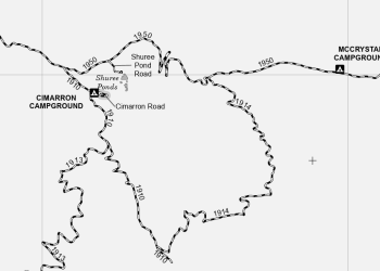
| Canjilon Ranger District | Canjilon Ranger District | |
| Cebolla Mesa Trail | GeoPdf | Trail #102 |
| Centennial Trail | GeoPdf | Trail #100 |
| Comales Trail | GeoPdf | Trail #22 |
| East Fork Trail | GeoPdf | Trail #56 |
| Gold Hill | GeoPdf | Trail #64 |
| Indian Creek | GeoPdf | Trail #27 |
| Lost Lake | Trail #91 | |
| Pecos Wilderness Trails | GeoPdf | Pecos Wilderness Trails |
| Trampas Hidden Lake Trail, San Leonardo Trail | GeoPdf | Trampas Hidden Lake Trail #31, San Leonardo Trail #30 |
| Tres Piedras Trails | Tres Piedras Trails | |
| Valle Vidal | Valle Vidal |