

West Fork Trail No. 108
There are a number of reasons why West Fork is one of the most popular trails on the Coconino National Forest. Once you've strolled beside the pleasant little stream that ripples along the canyon floor and looked up, way up, at the dizzying cliffs that tower above it, you will fall in love with it, too.
West Fork is fantastic throughout the year. In springtime, migrating songbirds decorate the trees with flashes of brilliance. In autumn, the canyon is ablaze with color, with red and gold leaves floating in clear reflecting pools under a canopy of solid color. In wintertime, icicles decorate from red rock overhangs, and snatches of snow persist in cool shadows. As a matter of fact, you'll probably find a new reason to be here every time you visit.
As for the trail itself, it's an easy stroll, but you do have to cross the stream in a number of places. Usually, that involves negotiating a few strategically placed stepping stones or taking a couple of steps in shallow water. The trail is marked and maintained for the first three miles.
Many hikers explore beyond the end of the maintained trail. Eventually the pathway ends, the route becomes more strenuous, and you will be forced to hike in the stream bed as you continue into the Red Rock-Secret Mountain Wilderness. If you choose to hike the entire 14-mile stretch from one end of the canyon to the other, see Information for Full West Fork Canyon Trips before you do. It's no easy stretch and there are things you need to know before you go.
No matter how long a hike you take here, you'll enjoy it best if you come at a time when the trail is least crowded. Mornings and weekdays are best, better yet if they're in the off-season.
When you do come, remember to take special care and leave this beautiful place better than you found it. Of course you know not to litter, but picking flowers and autumn leaves can cause just as unsightly a scar. So can short-cutting or rock throwing. Treat this natural treasure with the care it deserves and you'll have plenty of reason to come back and see it again and again.
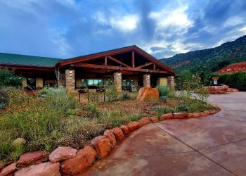
Photo Gallery


Specific Trail Information
Trail Number
General Information
- Difficulty: Easy, for first 3 miles. (If you are planning to attempt the entire 14-mile rugged wilderness route between SR 89A and Forest Road 231, please see Information for Full West Fork Canyon Trips before you do).
- Trailhead Elevation: 5,325 ft.
- Elevation Gain:
- 52 ft. (@1 mile)
- 107 ft. (@2 miles)
- 221 ft. (@3 miles)
- 1,178 ft. (@14 miles)
- Length: 3-14 miles.
- Time: 2-3 hours round trip if hiking the first 3 miles.
The West Fork Trailhead and Call of the Canyon Picnic Area are operated by a concessionaire, which charges a fee and honors the Coconino Pass which can be obtained at the parking lot entrance.
- Daily: $15 (covers up to 5 people)
- Weekly: $20
- Annual: $50
- Walk-in: $4
- Nothing mechanized is allowed on the trail, as this is in a designated Wilderness area. That means NO mountain bikes or bicycles.
- Dogs must always be on a leash, and owners must pick up after their pets. DO NOT leave bags of poop from your pets along the trail/trailhead for picking up later. If your pet defecates, you must bag the poop and take it with you. If you do not want to do this, do not bring your pet on trails.
- The trail may be closed during times of high fire danger, usually in late June.
Address: 8375 State Route 179, Sedona, AZ 86351
Phone: 928-203-2900
Hours: Wednesday 12 p.m.-4:30 p.m. All other days, open 9 a.m.-4:30 p.m. Closed Thanksgiving, Christmas and New Year's Day.
Office Email: SM.FS.Cof_Webmail@usda.gov
Getting There
Parking
IMPORTANT!! During busy summer months, traffic into Call of the Canyon/West Fork can become backed up on state Route 89A. If that is the case, please DO NOT spend a lot of time asking questions at the entrance gate. Simply state which Coconino Pass you want to purchase to gain entrance and move your vehicle forward to find your parking space. All the information you need to know about this trail is on this website. Additionally, all the information about the Coconino Pass and what it covers can be found by clicking on this Coconino Pass link.
Directions
Location: 17.5 miles south of Flagstaff (9.5 miles north of Sedona) on paved roads in scenic Oak Creek Canyon.
Access: Drive south 17.5 miles south from Flagstaff or north 9.5 miles from Sedona to about halfway between milepost 385 and 384. The trailhead is on the west side of the highway down a paved lane that leads behind a few creek side houses. Park at the Call of the Canyon Picnic Site.
GPS (Map): 34°59'26.5"N 111°44'34.6"W
Additional Map Resources: