

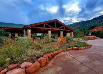
Call of the Canyon Picnic Site
This picturesque picnic area pulls double duty as the trailhead for the West Fork of Oak Creek Trail. The trail runs alongside a stream into a stunning side canyon brimming with splendid maple trees and other scenic wonders. This site is especially popular during the peak of fall color season.


General Information
- April 1 - September 30
- 7 a.m. to dusk
- October 1 - March 31
- 8 a.m. to dusk
Call of the Canyon accepts either:
- The Coconino Pass, or
- The daily rate, payable at the gate.
Interagency passes such as the America the Beautiful pass are not accepted at Call of the Canyon.
Day use only. Camping is not permitted at this site.
Cash, check and credit cards are accepted.
- Day-use: $12 per vehicle (up to 5 people)
- Walk-in, bicycle, bus: $3 per person
Contact Name: Coconino Hospitality
Contact Phone: 928-203-0624
Address: 8375 State Route 179, Sedona, AZ 86351
Phone: 928-203-2900
Hours: Wednesday 12 p.m.-4:30 p.m. All other days, open 9 a.m.-4:30 p.m. (Closed on federal holidays)
Office Email: SM.FS.Cof_Webmail@usda.gov
Getting There
Latitude / Longitude
Latitude: 34.99039
Longitude: -111.7431
Elevation
5,324 ft.
Directions
Location: 17.5 miles south of Flagstaff (9.5 miles north of Sedona) on paved roads in scenic Oak Creek Canyon.
GPS (Map): 34°59'26.4"N 111°44'32.7"W
Access: Drive south 17.5 miles south from Flagstaff or north 9.5 miles from Sedona to about halfway between milepost 385 and 384. The West Fork of Oak Creek trailhead is on the west side of the highway down a paved lane that leads behind a few creekside houses.
Parking
Call of the Canyon features a paved parking lot that fills quickly.
Facility and Amenity Information
Accessibility
Water
Potable water is not available at this site.
Picnic Tables
Picnic tables are available at this site.
There are six distinct picnic sites at Call of the Canyon.