
Brave the Elements
The high country of the Coconino National Forest is located in a high elevation zone on the Colorado Plateau. In this region, elevations above the Mogollon Rim are typically around 7,000 feet above sea level — rising to nearly 13,000 feet above sea level at Humphreys Peak, and 9,000 feet above sea level (or more) in the surrounding Cinder Hills.
The weather of the Coconino National Forest varies drastically depending on season. Winters can be cold and snowy with temperatures frequently dipping below freezing, and summers can be dry and hot. Northern Arizona visitors should plan accordingly and keep safety in mind during all seasons here on the forest.
When you travel into the forest away from managed recreation facilities, you are on your own.
You may find yourself in an area without cellphone service. If you can call for help, it could take hours for help to get to your location. Planning in advance, knowing how to stay safe, dressing appropriately, carrying the right gear, and being prepared for an emergency could make the difference between life and death.
Prepare for Inclement Weather
In addition to preparing for hot and cold temperatures, prepare for rapid changes in weather conditions. Check appropriate websites for news, closures and alerts.
- Keep an eye on current and predicted weather conditions. Flash floods, high winds, triple-digit heat and significant winter conditions can create rapidly changing and dangerous conditions.
- Watch for red flag, flood, heat or winter warnings.
- Know the signs for approaching storms or changing weather conditions.
- Find shelter in a densely forested area at a lower elevation.
Plan for Summer's Hazards
Lower elevations on the Coconino National Forest present all the challenges and safety hazards that accompany a desert climate, especially in the hot summer months.
Remain aware of high temperatures, limited shade and low humidities during summer months on the Coconino.
Drink plenty of water to avoid dehydration. Consider carrying rehydration salts and avoid caffeinated and carbonated beverages. Always bring more water than you think you'll need. A minimum of 1 liter per person per hour is recommended in hot conditions. Dehydration is one of the most common reasons for rescue!
While it's impossible to avoid summer's heat, the risk of many heat-related illnesses and injuries can be avoided with preparation.
- Begin hikes early to avoid the heat of the day.
- Seek shade when it's possible, using a shelter, umbrella or tree.
- Avoid hiking between the hours of 10 a.m. and 4 p.m., when the sun is at its brightest and the heat is at its highest.
When it’s possible, wear long pants, shirts with long sleeves, and a broad-brimmed hat. Not all fabrics are made equal. In fact, a typical T-shirt provides less than the minimum recommended sun protection of (sun protection factor) SPF 15. Wet clothes also provide far less sun protection.
There is some clothing that is certified by international standards and provides information about its SPF.
Sunscreen works by reflecting, scattering or absorbing sunlight. It is recommended that SPF 15 be used at a minimum. The higher the SPF, the stronger the protection.
Sunscreen should be applied to any exposed skin when you are outdoors. It needs to be reapplied every two hours and after sweating, swimming or toweling off.
Sunscreens also expire. Those without expiration dates has a shelf life of no more than three years—less if it is stored in high temperatures.
Your eyes also aren’t immune to the effects of UV radiation. UV radiation can cause cataracts and other eye disease. Sunglasses should provide both UVA and UVB protection. Most sunglasses sold in the U.S. provide that protection.
For more information on protecting yourself from the sun and preventing skin cancer, visit the U.S. Centers for Disease Control and Prevention.
Monsoon season is one of the most beautiful times of year in Arizona's high country... and one of the most dangerous. Monsoon storms sweep in quickly, bringing dramatic skies, cooling rains, and dazzling displays of lightning. These storms can easily catch forest visitors unprepared and unaware of the dangers
Nowhere outdoors is safe during a lightning storm. Many visitors are unaware of the measures they can take to lower their risk of being struck. Know before you go. Educate yourself about lightning strikes. Stay near safe shelter and try to avoid high terrain, golf courses, and bodies of water during high lightning activity. Monsoon storm activity typically occurs starting in the late morning through the afternoon. However, storms may pass through during the evening. Keep an eye on the weather forecast for the latest, most accurate storm predictions.
If you are caught in a lightning storm...
Immediately seek shelter in a modern building or metal-topped vehicle.
Convertible cars, gazebos, porches, golf carts and other open vehicles and buildings will not shield you from a lightning strike. Do not lay down or lean on concrete floor and walls.
Descend quickly if you are caught above the tree line or on top of an exposed hill, ridge, or peak.
Get below the tree line as quickly and safely as possible and into a group of trees. Avoid the tallest and isolated trees.
Drop metal objects
Ditch the hiking poles, packs with internal or external metal frames, golf clubs, tennis rackets, and umbrellas. It's better to lose your gear than your life.
Get off bicycles, motorcycles, horses, and golf carts. Get away from power lines, fences, and other metal objects.
Spread out at least 15 feet apart.
A lightning strike can be hazardous 50 to 100 feet from the strike point. If you are with a group and the threat of lightning is high, spread out at least 15 feet apart to minimize the chance of everybody getting hit.
Avoid isolated trees, rock overhangs and cliffs.
It is better to seek shelter in a forest or group of trees. Choose an area with shorter trees.
Get as low as possible if caught in an open area with no shelter.
Crouch with your feet together and head low. Never sit or lay on the ground. These positions provide much more contact with the ground, providing a wider path for lightning to follow.
Do not make camp near the tallest trees. Lightning storms can develop in the middle of the night. Lower your chances of a lightning strike at camp, by pitching your tent away from the tallest trees in the area.
Get off the water.
Swimmers, anglers and boaters should get off lakes or rivers and seek shelter when storms approach. Drop any fishing rods. Boaters who cannot get off the water before the storm hits should crouch low. Once on land, get at least 100 yards away from shore.
Wait 30 minutes after the thunder stops before leaving shelter.
People have been struck by lightning near the end of a storm, which is still a dangerous time.
If someone is struck...
Seek professional medical attention as soon as possible.
Avoid further injuries
Get to safety as quickly as possible. Injured victims may be disoriented and require assistance. In hazardous conditions, waiting for the storm to pass before tending to incapacitated victims may be necessary to avoid others being injured.
Tend to the victim
People who have been hit by lightning carry no electric charge and can be safely tended to. Also, victims who appear dead can often be revived. If the person is not breathing, begin mouth-to-mouth resuscitation. But if a pulse is absent as well and you know cardiopulmonary resuscitation (CPR), begin CPR. Stay with the victim until help arrives.
Know before you go! Additional information and resources
- National Weather Service for Northern Arizona: Weather can change rapidly and is often unpredictable until the last moment. Watch the weather forecast closely before and during your outdoor adventure.
- Lightning Safety [NWS]: Get lightning safety tips and learn more about lightning from the National Weather Service
- Lightning Safety Education [NOLS]: Indepth information on lightning safety and risk management from the National Outdoor Leadership School
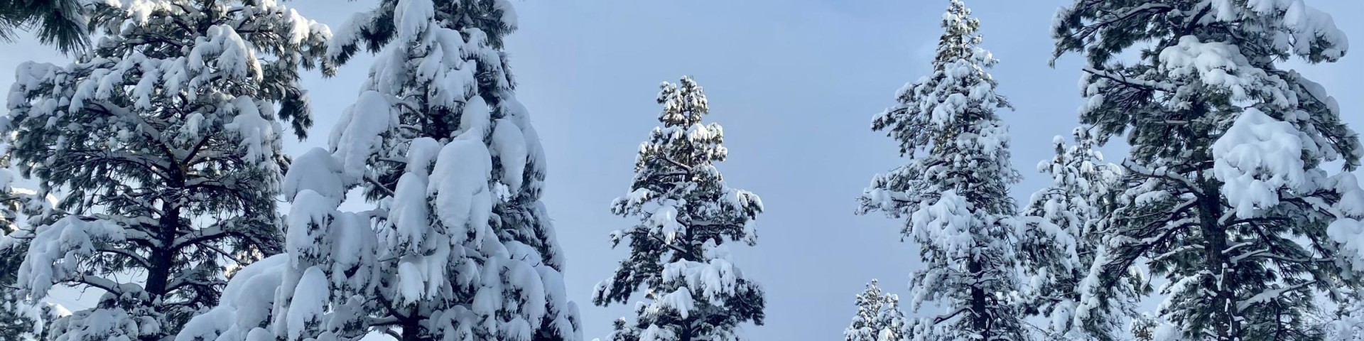
Prepare for Winter Weather
Northern elevations of the Coconino National Forest can average more than 100 inches of snow per year. While this allows visitors to enjoy all that snow has to offer — including skiing, sledding and snow play — it comes with risks.
Remain aware of freezing temperatures, avalanches and treacherous terrain during winter months on the Coconino.
Snow and Winter Safety Tips
Know the current conditions and the forecast. Weather in the Flagstaff and Rim Country can be unpredictable. A sunny day can quickly turn into a blizzard.
Kachina Peaks Avalanche Center
Arizona avalanche information and snowpack summaries.
Avalanche.org
A national resource for avalanche information.