

Visitor Maps and Guides
Learn everything you need to know for your visit!
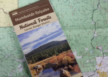
Visitor Guide

The Visitor Guide offers essential information to enhance your experience on the Humboldt-Toiyabe National Forest. It covers the area's history, details its diverse flora and fauna, and includes recreational information for all the ranger districts on the Forest.
Free Downloadable Maps
Looking for a map to help plan your trip to the Humboldt-Toiyabe National Forest or other national forest and grasslands? Click the links below to access free downloadable or interactive maps to help get you started.
Interactive Forest Map Finder
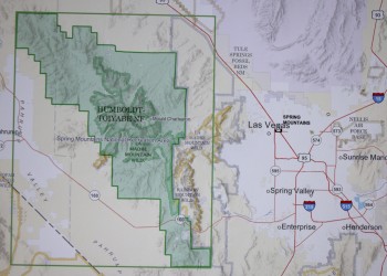
The Interactive Forest Map Finder link below is the quickest access to find and purchase the Forest Visitor Maps. The Forest Visitor Maps of each National Forest and Grassland provide forest-wide information on attractions, facilities, services, and opportunities. Some maps are readily available to purchase at your Forest District offices. Please contact the local forest directly to check on availability.
Map Finder
The links found in the Forest Map Finder will take you to the following sites: district offices selling the maps locally, US Geological Survey for online sales, Avenza Map Store for electronic (GeoPDF) maps, and links to the free official Motor Vehicle Use Map (MVUM) displaying roads, trails, and areas open to motor vehicle use in the National Forest.
Also learn more about Geospatial Data for the Intermountain Region forests.
Forest Service Digital Maps
Forest Service Digital Maps cover all lands administered by the Forest Service. There are available at a variety of scales. Maps are free as a digital download.
Paper Maps for Purchase
Forest Visitor Maps
Forest Visitor maps are forest-specific maps created by each National Forest. They have rich content specific to each forest, providing forest-wide information on attractions, facilities, services, and opportunities. These maps are professionally printed with tear and water-resistant paper and are available for purchase.
National Forest Atlases
National Forest Atlases are full-color printed atlases containing 8.5-inch by 11-inch topographic quadrangle maps at 1 inch to the mile scale and are available for purchase by many of the National Forests.
Wilderness Maps
Wilderness Maps are topographic maps that provide content specific to wilderness areas managed by the Forest Service. Each map covers all or part of one wilderness area, and the scale is generally 1 inch per mile (1:63,360). These maps are professionally printed with tear and water-resistant paper and are available for purchase.
Purchase a Forest Visitor Map
Forest Visitor Maps, Forest Atlases, and Wilderness Maps can be purchased through the USGS Map Store. Paper maps are also available at the relevant National Forest office. For maps specific to the Humboldt-Toiyabe National Forest, it is recommended to call the local Forest Service office in advance to check on availability.
Motor Vehicle Maps (MVUM)
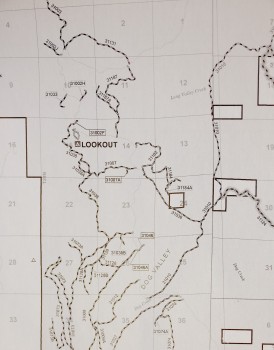
A Motorized Vehicle Use Map (MVUM) is a legal document that shows which roads and trails are open to public motor vehicle use. If a road or trail does not appear on the map, it means that it is not open to public motor vehicular use.
The MVUM is a black and white map with no topographic features. It is best used with a Forest Visitor Map or other detailed map. The MVUM will be updated as needed to correct mapping errors or discrepancies and update travel decisions.
If you plan on camping, driving off-highway vehicles, hunting, or exploring the backcountry; please make sure you review the appropriate MVUM to know which routes are open to motor vehicle use. For more information, please visit MVUM Frequently Asked Questions and KNOW BEFORE YOU GO!