
Upper McCloud River Loop
The McCloud River Loop
Are you interested in camping, fishing, hunting, hiking, boating, picnicking, snowmobiling, cross country skiing, or sightseeing? The choices for recreation are almost unlimited on the McCloud District.
For information on the McCloud River Loop Dispersed Camping Restrictions please select the link below:
During the late spring, summer and early fall, the McCloud Area offers fishing, hunting, swimming, camping, hiking, photography opportunities, and spectacular scenery. During the winter months, snowmobiling, cross country skiing, snow- shoeing, hunting, fishing, and downhill skiing are the top-ranking outdoor opportunities.
There are a number of developed campgrounds and day use facilities located along the scenic McCloud River, that includes Fowlers, Cattle Camp, and Camp 4. Fowlers CG has 31 reservation-only sites and 8 first come, first served sites. Camp 4 is a reservation only group campground. You can reserve a site at recreation.gov. There is a 14 day stay limit at our campgrounds. Cattle Camp is first come first served. Developed campgrounds begin to open May15th.
The McCloud River parallels Highway 89 from its source near Dead Horse Summit to Fowlers Campground. There it turns south and continues through private property to the McCloud Reservoir. At the "Res" as it is known locally, the river again flows through National Forest lands to a point several miles below AhDiNa Campground, plus several other areas downstream to the Nature Conservancy's McCloud River Preserve. From here, the river passes through mostly private property and public access from the banks is extremely limited until the river enters the McCloud Arm of Shasta Lake.
Active Alerts
Reservations
Reservations only exist at Fowlers and Camp 4 Group Site.
General Information
The McCloud Ranger District Office: Open Tuesday, Thursday, and Friday, 8:30am to 4:30 am. Wednesday and Saturday, 8:30am to 12:00pm. Closed on Sunday, Monday, and Federal Holidays.
Neither Dispersed Camping nor overnight backpacking is allowed on the McCloud River Trail between Lower Falls and Cattle Camp.
Campfire permits are required outside of a designated campsite and may be obtained free of charge online. Please check our forest orders page for current campfire restrictions. Or call McCloud Ranger Station.
The fee for Fowlers is $15 per night, Ah-Di-Na is $10 per night, and Cattle Camp is $15.
All other camping areas such as Algoma and Ash Camp are free, undeveloped, and they each have vault style toilets.
Undeveloped campsites are user maintained. Please pack out all that you pack in.
Pets are allowed in the recreation areas unless posted. They must be on a leash not longer than six feet, or otherwise under physical restrictive control when in a developed site.
Contact Name: McCloud Ranger Station
Contact Phone: (530) 964-2184
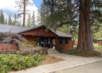
Address: 2019 Forest Road McCloud, CA 96057
Phone: 530-964-2184
Hours: Friday and Saturday, 8:00 am - 4:30 pm (Closed on federal holidays)
Getting There
Elevation
3200' to 3600'
Directions
From McCloud travel 5 miles southeast along Highway 89. You will see a Forest Service sign on the lefthand side of highway that reads Fowlers and Lower Falls. Turn right onto the McCloud River Loop Road (40N44) at this sign. Continue along this road through the intersection and stay right at the fork. (The left will take you to the campground). Soon you will come to the Lower Falls Day Use and parking area. The trailhead (TH) for the McCloud River Trail starts at the staircase next to the Lower Falls overlook.
Travel Considerations
There are gates that are closed during the winter, from November 1 through April 1, on road 40N44, at the entrance off of Hwy 89, and Northwest of Bigelow Rd, near the entrance to Upper McCloud Falls. Travel is restricted on Road 40N44, to the Southeast, during snowfall.
Facility and Amenity Information
Restrooms
Restroom information is not currently available for this site.
Water
Potable water is available at this site.
There is drinking water located at Lower Falls Day Use, Fowlers Campground, and Cattle Camp campground.
Picnic Tables
Picnic tables are available at this site.
Day use areas and campgrounds have picnic tables and Bar-B-Que grills.
Horse/Pack Animal Information
Horse/Pack animals are allowed at this site.
Upper Falls only, not recommended on lower and middle falls; please call the office for specific information.
Recreation Opportunities
Boating - Non-Motorized Info
This is a class III+ river with sections that require class IV+ skills in some areas. Please call the office for more details.