
Incident Information
If you don't know where the fire is burning, the most effective way to learn about incident information about a particular fire is to search by your state or for larger established incidents use Inciweb. The Southern Group of State Foresters website hosts a lot of great fire information about your risk assessment and tools to be fire safe.
Additional Links:
More Information
Incident Management Situation Report (IMSR) - a daily report, except in times of slow incident activity, of wildland fires and incident response. The report shows an overview of incidents, grouped by geographic area. Report details include fire names, sizes, percent contained, personnel assigned, estimated costs, etc.
Air Now is your one-stop source for air quality data. Our recently redesigned site highlights air quality in your local area first, while still providing air quality information at state, national, and world views. A new interactive map even lets you zoom out to get the big picture or drill down to see data for a single air quality monitor.
The National Wildfire Coordinating Group hosts on the National Fire Situational Awareness page, where users may access the map in a full browser view.
Inciweb
Stay informed about wildfires and natural disasters by visiting InciWeb. Click the button below for real-time updates, safety information, and resources to help you prepare and respond.
Wildfire Map NASA
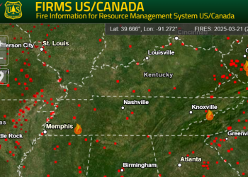
NASA's Fire Information for Resource Management System (FIRMS) provides access to near real-time data related to wildfire activity.